Your question's not specified how far before Columbus, but I can point you to one map that certainly expresses the idea you're suggesting: the T and O map.
http://upload.wikimedia.org/wikipedia/commons/7/70/T_and_O_map_Guntherus_Ziner_1472.jpg
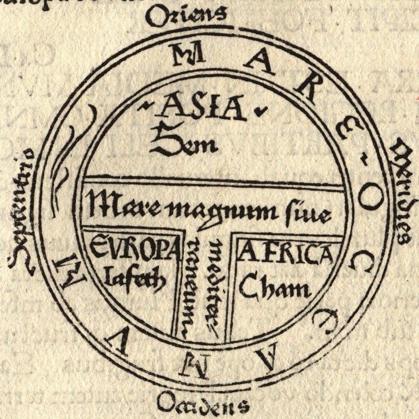
Now, this (or a similar map) was originally drawn by Isidore of Seville, the 7th century scholar, in his widely published and well known Etymologiae, a sort of encyclopedia, and this picture is of a page of a 1472 edition of the book, printed in Augsburg. This sort of map is similar to things like the Mappa Mundi:
http://upload.wikimedia.org/wikipedia/commons/1/17/Hereford_Mappa_Mundi_1300.jpg
and while it's not necessarily easy to interpret (there's some debate, for example, about whether it shows a round or a flat earth, and 'round' fits in with a context of an impassable equator), it certainly shows a perspective as late as 1300 at least of 3 continents and one 'ocean sea' surrounding them all: the atlantic and pacific combined.
Grapp, could you clarify what you mean? I take the question to essentially be asking whether or not there were people who hypothesized about a continent somewhere between the western coast of Europe and the eastern coast of Asia, not whether people really believed the Earth was flat, but based on the answers removed here, I'm not sure people are getting that.