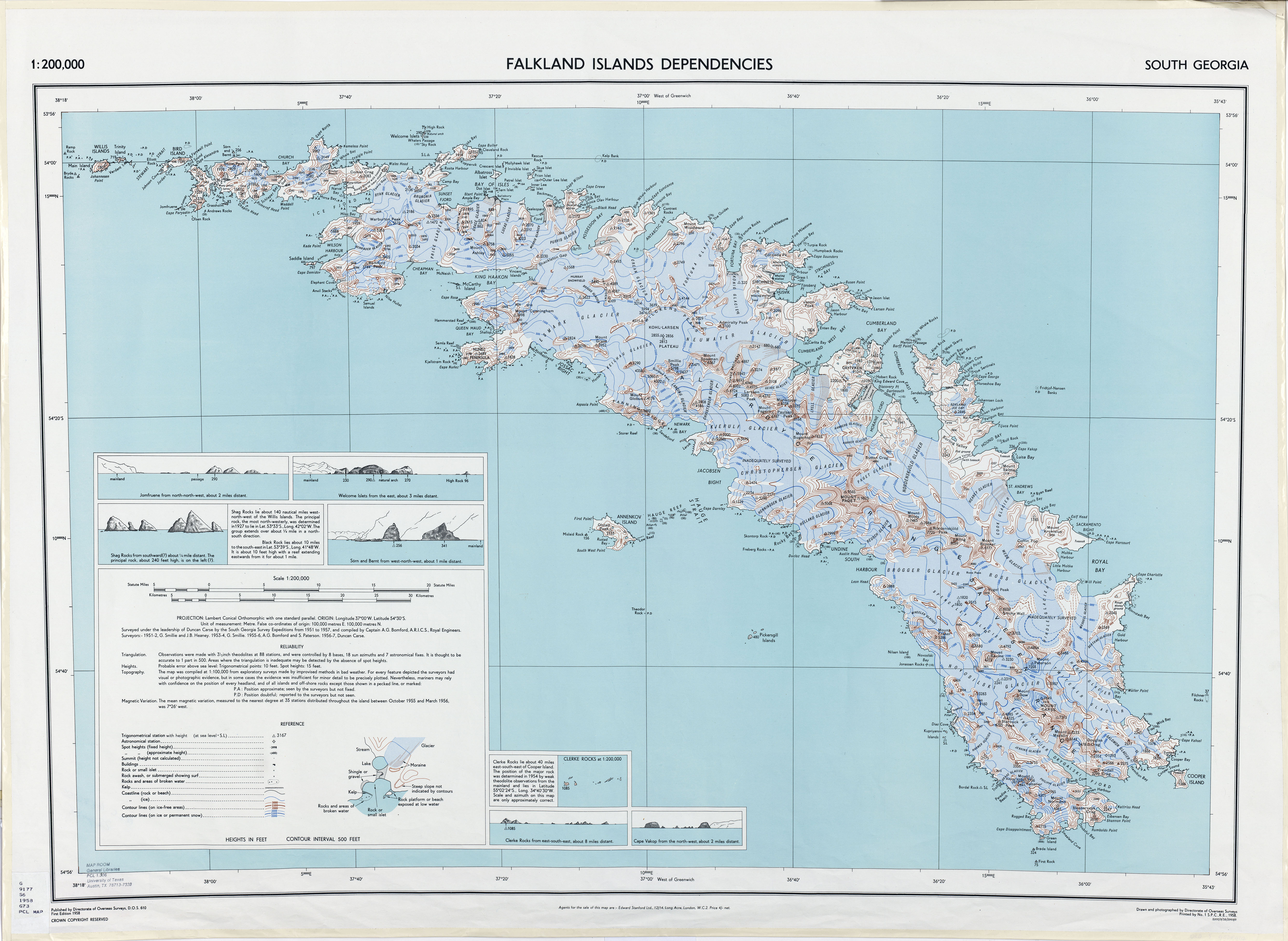
I've been reading the account written by Shackleton (South) about his famous Antarctic expedition. I was especially amazed about how he and his men survived their hike across the remote British territory of South Georgia after their 800 mile open boat journey. His book says that they landed on the southern side of the island and hiked from King Haakon Bay to Stromness Harbour, at the time the site of a whaling station. Something doesn't make sense though, according to this map there is another much closer settlement called Prince Olav harbour which although marked as derelict on the 1950's era map would have been open in 1916 (it was abandoned in the 1930s according to Wikipedia).
This map shows this even more clearly, he could have avoided a larger mountain range, a couple of glaciers and a lot of miles by heading north to Prince Olav harbour instead of heading east to Stromness. Was he unaware of the station's existence or did he have a particular reason for heading to the more distant Stromness station?
I do know Prince Olav was occupied at the time and old Ernest would have save himself some serious trouble and much time by simply walking north.
My guess is he went for the sure thing - Stromness - rather than risk an empty Prince Olav.