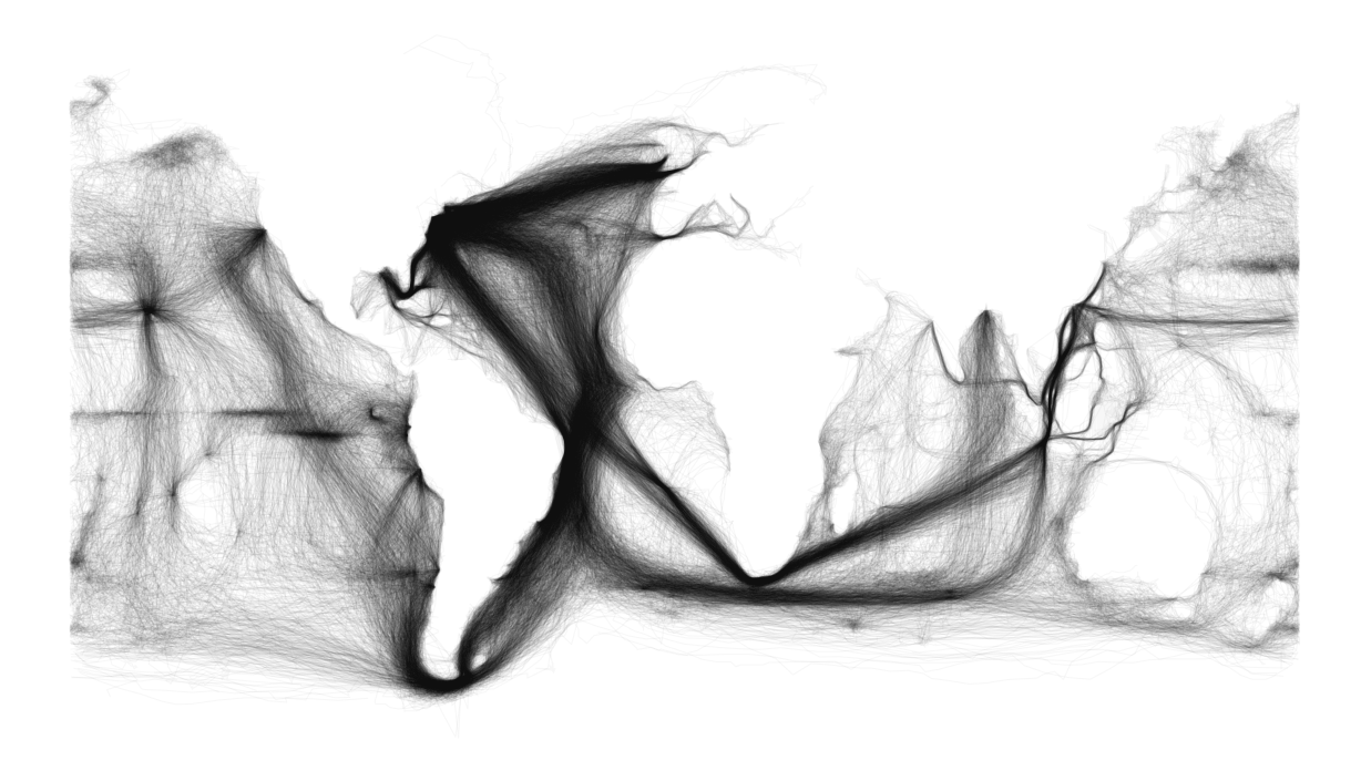
This map is a plot of all ocean voyages contained in millions of entries contained in the Maury collection, a collection of ship logbook entries chronicling global shipping (and weather data) from 1792 to 1910, currently in the possession of NOAA National Climatic Data Center. The entire collection was digitized in 1998.
For comparison purposes, today's global shipping plot.
Edited to add sources:
http://sappingattention.blogspot.com/2012/11/reading-digital-sources-case-study-in.html#more
Chilean here.
To put you in context, Valparaiso was perhaps the most important port in the Pacific shore during the first half of XIX century. This lasted until 1865, when Chile went to war against Spain (again) and, as Spain was defeated and retreating with the remains of the fleet, they decided to bombard Valparaiso on their way home.
Valparaiso was a commercial port, not prepared to repel such attack. There were British and American ships on the port, whose captains opposed the Spanish action because it violated implicit laws of war. In the end, being outnumbered, they chose not to interfere and just left the port during the bombardment. The spanish fleet then proceeded to the bombardment and left a few hours later back to Spain leaving a ruined port, three dozen sunk freighters, hundreds of civil casualties and a vivid memory of the spanish sense of "honor".
While Valparaiso was rebuilt, in the in-between El Callao, in Peru, rose to be the most important port in the Pacific coast. Valparaiso never got back to its former glory.
Even being the second in importance, the surge in mining explotation and exports during the next 3 decades gave enough traffic to the zone for even smaller ports to be profitable. This prosperity lasted until the beggining of the next century. It turns out that Chilean main export was Nitratine, but then germans invented an artificial substitute that performed well enough as a farming fertilizer for a fraction of the cost. This rendered nitratine obsolete and, when Panama Canal was open, chilean expots were only a fraction of their former volume.
Valparaiso and El Callao where a forced stop for any ship that passed through Cabo de Hornos in its way to or from Europe. This route was slow and very dangerous, and even those ships that passed Cabo de Hornos unharmed, they still had to pass throuh Gulf of Penas which claimed many ships and lifes throughout history. So yes, as any intermediary, Valparaiso and El Callao took their benefit on traffic, but traffic itself was impaired because the lengthy and dangerous route around Cabo de Hornos.
Fast forward to when Panama Canal was opened, Valparaiso wasn't a midway station anymore, but the very end of the route. Panama Canal offered a faster and safer route to europe. As shipping costs dropped, many local manufacture and produce became now viable for exportation. Many imported european products became more affordable and saw their demand increased.
TL /DR So all in all
Sources:
Side question: How was the situation after the construction of the seuz canal in 1869?