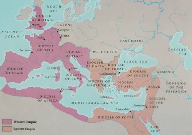
Maps such as these are often used to represent the division of the Roman Empire in the 3rd and 4th centuries:
http://www.littlejohnexplorers.com/jeff/history/twoempires.jpg
My question is: when travelling from Western to Eastern Europe, was there ever any equivalent to a sign that said "now entering the Eastern Roman Empire" (something less obvious than that, of course)? At one point did you stop being under the authority of the Western court and answer to Constantinople? Were there "border" towns? Was there any physical border marker between the two jurisdictions?
Another, tangentially related question: are there any signs put up today to mark the historically recognized dividing point between East and West (an equivalent to Hadrian's Wall)?
Damn I wish someone had answered you :( Was hunting for this exact question.