To start simply, I'll offer book recommendations first: Ecological Imperialism: the Biological Expansion of Europe, 900-1900 by Alfred Crosby and Changes in the Land: Indians, Colonists, and the Ecology of New England by William Cronon. Crosby introduces the topic of the Columbian Exchange in general, while Cronon focuses specifically on the changes to New England in the colonial period. Both are founding works on this topic. To a lesser extent, you should check out 1491: New Revelations of the Americas before Columbus by Charles Mann. It's more concerned with the the people of the Americas, but it does occasional touch on ecological topics too.
Since I have Cronon on hand though, let's start by looking at New England. When the Italian explorer Verrazzano arrived in what is now Rhode Island in 1524, he described the numerous villages stretching along the coast, and people so numerous that he could smell their fires burning while still miles out at sea. The forests along the coasts of New England were so clear of undergrowth that he said "a large army" could easily march through them. These open, park-like forests were also described by permanent colonists a century later, with one say "Whereas it is generally conceived that the woods grow so thick that there is no more clear ground than is hewed out by the labor of man, it is nothing so, in many places diverse acres being clear so that one may ride ahunting in most places of the land if he will venture himself for being lost."
While this colonist, William Wood, seems to contrast the openness of these forests with narrow paths "hewed out by the labor of man," the park-like conditions he enjoyed were not the handiwork of nature. Throughout eastern North America many forests were under careful and controlled management by local communities. The greatest tool in their forestry arsenal was fire, and through two annual controlled burns (once in spring and once in the fall), the much of the forests were kept clear for a variety of purposes. Easing travel was only one; it is also promoted to growth of and habitat for economically important plants and animals, while discouraging those deemed undesirable. These fires were also useful for driving game and clearing land for farming. In northern New England, where this practice was not employed and the trees tended to be coniferous, the forests were dense and difficult to traverse outside of designated paths and waterways.
Other portions of New England were completely open, without trees at all, especially near what's now Boston. Elsewhere there were swamps which were frequently employed as hidden refuges in times of war. Over all, the land was a "patchwork" of habitats, many of which were created and maintained by human efforts.
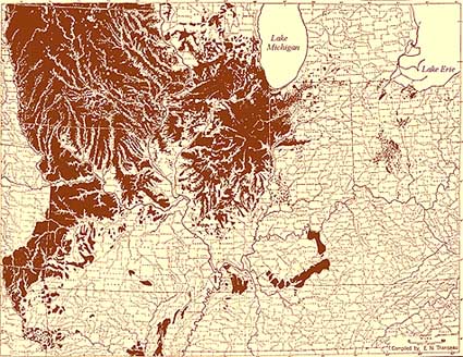
To give you another example, here's a map of the vegetation in Ohio at the time of the first land surveys (late 1700s / early 1800s for the most part), when American settlers began moving into the region. The northeast corner is of particular note here. It included oak savannas which are the natural equivalents to those open forests the first English colonists encountered in New England. While most of the oak savannas have been destroyed now, there are few still left in the area and a few other places in the US. Here is what they look like. They're essentially a transitional zone between the Great Plains and the eastern forests, as the climate and / or soil begins to become too dry to support trees that prefer wetter habitats like maples and beeches.
The oak savannas in northeast Ohio are mainly due to their soils, which is mainly sand dunes from the ancient shore of Lake Maumee. The large swath of purple in stretching along the Maumee River was an elm-ash swamp known as the Great Black Swamp, which is were the lakebed of old Lake Maumee was before it drained into modern Lake Erie at the end of the Ice Age. The swamp was notoriously abysmal - difficult to cross to cross, infested with mosquitoes, and sparsely populated by people, mainly on the periphery or the Maumee River. The main settlement in the region was Kekionga (populated largely by Miami, with some Lenape and Shawnee as well), where Fort Wayne, Indiana is now. It sat on the portage route between the Maumee and Wabash Rivers, and thus controlled and profited from the trade going between the French outposts at Detroit and St. Louis. The swamp was mostly drained in the later half of the 1800s, though some small portions of it remain today. You can see images of those places here.
Scattered through the forests between Columbus and Dayton, you'll notice little Prairie islands. These are remnants of the Prairie Peninsula, an eastward extension of the Great Plains into central Ohio. The Prairie Peninsula stretch into the area during the a lengthy dry period some 8000 years ago and has slowly been retreating. By the time the settlers arrived, it had been largely pushed back to Illinois (map). These little prairie islands are that remained in Ohio at the time American settlers moved in, though we know they once reached even further east - when the Newark Earthworks were built around 250 CE, that area was a prairie island too, but it was forested by the time Euroamericans showed up.
Since I mentioned the Newark Earthworks (located here), I should also mention the nearby Cherry Valley. It was named for the surprising number of cherry trees that grew in the area when the American settlers arrived, despite it not being ideal habitat for those trees. Most likely, this unusual cherry forest began as an indigenous orchard that had since gone feral and become self-perpetuating. It might have first been planted by the Lenape when they moved into the area in the 1700s; though at least one archaeologist (Brad Lepper) has suggested that the forest might go back to the days when the Newark Earthworks was seeing regular use.
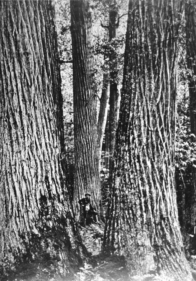
As for the rest of the forests, you can see on the map that they once covered much more of the state than they do now, and substantially more than what was left in the 1900s. The state's present forests are largely a post-WWII recovery (see here, courtesy of the Ohio Division of Natural Resources). Because the current forests are quite young and highly disturbed, they don't have quite the same mix of plants that they used to. For example, maples are particularly more common in the east than they used to be, due to a disruption of the normal fire regime that suppressed their growth in favor of oaks. Over all the understory is much more crowded than it would have been in 1800, and its full of non-native plants like Amur honeysuckle (especially if the forest is anywhere near a city). It's also missing some major elements. Most notably the American chestnut which once dominated the mature eastern forests, especially in the Appalachians, until the blight virtually wiped them out in the early 1900s (here's an old picture of some American chestnuts from the Great Smokey Mountains). A few managed to survive, so there's some hope of rebuilding the population.
I don't have sources for the East Coast and prairie, but for an example of what you are talking about I would recommend A State of Change: Forgotten Landscapes of California, which has the advantage of being thoroughly and nicely illustrated.