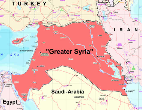
it's surprisingly hard to find an answer to this online.
edit: Thanks for all the good answers to this simple question. now if someone had an overlay of say a zoomed in version of /u/peisistratid 's post with a map of the modern world that would take the cake, but i don't want to be too greedy.
It can be a little confusing. "Syria" can mean a lot of different things in an ancient context, none of which match up perfectly to the modern state. First, "Syria" is the Greek pronunciation of Assyria, or more accurately Aššūrāyu, which basically corresponds to upper Mesopotamia. The Assyrians were so important historically that Greek geographers essentially called the entire region Syria that roughly corresponds to what would today be known as "greater Syria". Therefore, when the Romans conquered part of the region they named the province Syria. After the third Jewish Revolt was put down by Hadrian, Judea was merged with it into the province of "Syria Palestina".
Roman Syria therefore incorporates modern Lebanon and part of modern Syria.