Say that you and your men are in charge of a few artillery pieces and there's a forest in front of you, so you can't see through. Then an officer a few miles ahead calls for artillery fire on the enemy units. How would you then adjust the azimuthal angle (measured from the ground up) and the polar angle (measured on the ground in anti-clockwise direction) to fire exactly upon the enemy position? I know you can easily do it with physics, but you don't have the time to solve equations for every order you receive. So, how would these people proceed?
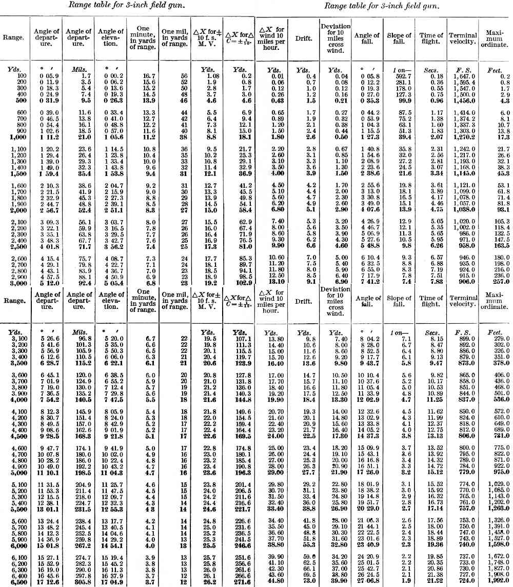
Pretty much the same as today only today they have more automated processes. They had fire tables with angles already computed. You just need to know the gun target line (azimuth) and the distance to the target. The distance the shell goes is determined by the charge (these are variable bags of power placed behind the shell) and the vertical angle of the gun together. The target location is either provided by the infantry or by a "FO" or forward observer using military map grid coordinates and sometimes a compass bearing and then relayed to the fire control center located with the artillery pieces. The artillery fire controllers can take a fire order in a number of ways including using the observed azimuth from the observer to the target. Once the Fire Controller determines the angles needed they relay the numbers from the fire tables to the gun crew who set the guns. They were still doing it this way when I left the Marines in 1986. I was an infantry officer in the Marines and if we had dedicated artillery support they could have rounds down range for us usually within a minute if they weren't setting up for a move. My father in law was an artilleryman in the Army for WW2, Korea and Vietnam and from our discussions- the procedures hadn't changed significantly in that time period.
They had printed tables like this from which they could get the required angles. (BTW, "azimuth" is a compass direction, zero azimuth is North, angles increase in a clockwise direction looking from overhead, so 90 degrees azimuth is due East, 180 degrees is South, and 270 degrees azimuth is West. "Elevation" is the angle measured from the ground up). Of course, before the battle the gunners had some idea of the range where they would be shooting so they made sure to have the relevant tables at hand.
The gunners needed feedback, there would be observers equipped with binoculars and field telephones to send back the needed corrections.
I'm not a historian, but this is very close to my specialty which is numerical analysis. One of the first applications of digital computers was in calculating artillery tables like this. When a new gun was developed, they first did a rough calculation using computers to generate a preliminary version of a range table, then they did field tests with the gun to get more accurate results.