In cities like Istanbul or Florence, how would finding someone's home be possible without street numbers?
Well first, Medieval cities were a whole lot smaller than nowadays so it was simpler to find your way around. I'll focus on Paris because that's what I know. In the 16th century, Paris was delimited by the Wall of Charles V (labelled as D on this map). Everything was basically within a 30 minutes walk, so if you lived there it was easy to know where everything was.
Still there were around 400 streets at the time and you needed a name to differentiate them. But until the 18th century, streets names weren't official. So streets were commonly known by whatever significant thing was there (a temple, rue du Temple, a prominent Burgundian population, rue des Bourguignons, etc). Kinda like nowadays you'd say you're "in the street with a Walmart", people in medieval Paris said they were "in the street with the painted house that goes to Montmarte". Obviously writing down an address tended to be a bit complicated and had to be descriptive enough. For example it could look like this : "monsieur Gascon, living at Pierrot's, near the Saint-Sauveur Church, in front of the bakery, 4th floor"
Now if that wasn't enough to find the house in question you could just ask around. As I said, Paris was smaller back then and people knew most people around the block, especially since corporations or immigrants tended to group together. Once you were in the close neighbourhood, asking a local would probably be enough to find someone's home.
Later in the 18th century streets were officially labelled, essentially for tax purposes. The population was, of course, not really pleased by this idea and often removed the street plaques. It wasn't until 1805 that street names and street numbers as we know it were definitely implemented in Paris.
T.L.D.R : Cities were smaller, people referred to their address by the closest significant location and if you were lost you could still ask someone.
Sorry for the bad English, I'm french.
Source : Yves Combeau, Histoire de Paris.
Jacques Hillairet, Dictionnaire historique des rues de Paris
And some memories from my history of urbanism classes.
I'm under the impression that streets were much less orderly then than they are now. Would every street have a name? Were the houses numbered?
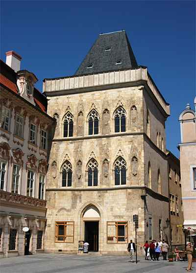
The houses had names. Famouses houses in Prague include Stone Bell House (notice the bell in the corner), house at Three Fiddles (a bit newer, the violin maker family placed the plaque around 1700s), or [Golden Ring house] (http://i.imgur.com/Dfn2jYy.jpg), now a gallery. When you walk around old cities you can see the symbols on the houses' façade even today.
Just to piggyback- were there local maps at the time? How common were they and who would have been able to read/follow/understand them?