The more detailed the better.
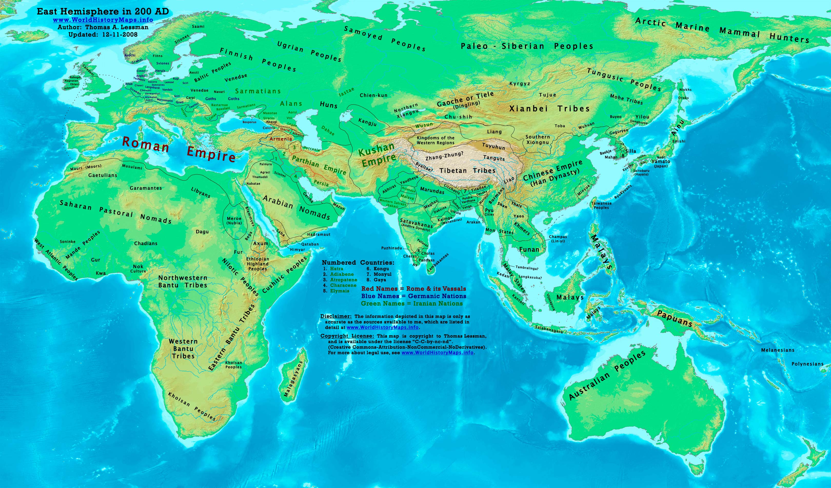
I have found this to be extremely helpful, and far more detailed than the others posted - and as this was the territorial peak of the Roman empire, there would be little change in the negligible seventy-five years between this maps 125 AD, and your desired 200 AD.
Is there a reason that the maps a google search brings up somehow don't cover your needs?
I have found these maps to be the most helpful. The cover the entire globe at numerous periods in history. Plus they show the tribes on the periphery.
Here is one for the year 200 AD: http://worldhistorymaps.info/images/East-Hem_200ad.jpg