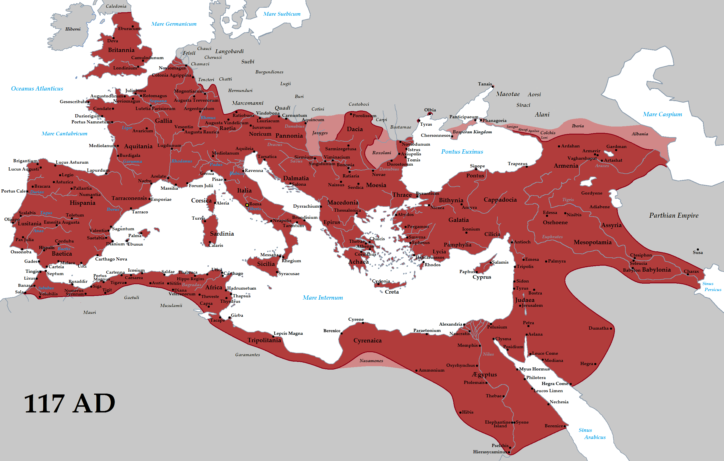
I've always wondered how we determine the borders of ancient empires, and how accurate the knowledge is. I'll be looking at this image of the Roman Empire under Trajan, but really I'm curious about how we have determined the borders of any ancient or medieval empire. I know we can determine how far Roman control extended by looking at what cities and tribes they subjugated, and things such as Hadrian's wall in Britain. But how accurate are the actual lines we see on maps such as this. Are they simple approximations, "connecting the dots" between places we know Roman control extended to? How do we know that control extended not far south of the gulf of Sidra, but farther in areas like Numidia?
Would ancient empires even have official borders, or would there be frontiers, where control eventually weakened to the point of nonexistence, and you would then be outside the empire?
Presume all modern maps of the ancient world as questionable. Though maps have always existed, maps as we understand them are devious tools for the creation of nationalism (see Benedict Anderson's Imagined Communities). They impose an artificial line supposing a clear demarcation of the entirety of culture, language, and economy (in our modern sense) onto an actual geography that does not have any such thing.
To give you an example of what I mean, consider this for a moment. If you live in a cosmopolitan major city, like say New York City, you as an urbanite have more in common with someone living 3,000 miles away in the city of San Francisco, than you do 100 miles away in rural upstate New York. The values, culture and politics are world's different, and yet, with maps (like the map of New York State itself), the connection between a city dweller and a rural dweller are forced into being similar.
This is exactly the problem of the modern maps of the ancient world. The territory under "control" in an ancient map does not express the same totality that we presume out of our modern maps, especially with regards to the people in the hinterland.
So when you see a hard and fast line, like the limes of Germania, or the "borders" of Persia and Syria, know that they're far fuzzier than that. Think of them as "zones of interaction."
Now with that said, control of cities and administrative centers absolutely mattered. They were fought over and negotiated in treaties, but the physical walled city or fortification was really as far as concerns over authority really were considered.
In a 4th century account of a female Christian traveler, she talks with another person about being near the Persian border, and how many staging posts it is to the city of Chaldee, but she can't go there because "Romans are not allowed to go there, since that whole area belongs to the Persians." Clearly there is an idea of what belongs to the Romans and what belongs to the Persians, but as mentioned previously, that's the political control of a walled town or fort. Not quite the same thing as a continuous shade of purple across everything around it, where suddenly now everyone speaks Persian whereas on this side everyone speaks Latin or Greek.