How clear a picture did they have of what their empire looked like?
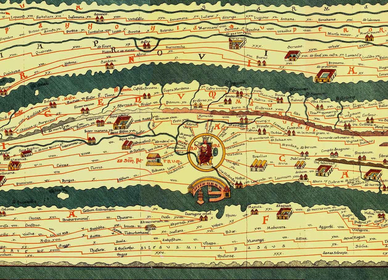
What sort of maps? World maps? City maps? Local maps? The Romans made maps of all kinds of stuff, down to maps of particular municipalities or private estates, which were often displayed publicly or openly in private homes. We have lots of these sorts of maps, which are often preserved in quite good condition. The most famous of these sorts of inscriptions, certainly of public maps rather than private maps of estates, is of course the Forma Urbis, a fragmentary Severan inscription that was publicly displayed at the Ara Pacis. It appears to be extremely accurate, and there seems to have been an earlier Flavian map that was even better. As for world maps, we only have one surviving genuine Roman world map, the Tabula Peutingeriana which exists in medieval copy, though the map is probably from late antiquity. You'll notice immediately that the map is horrible at showing real shape and distance. It's not supposed to, it's more of a road map than anything else, showing the major roadways of the Roman world and their courses, and if literally every other existing city and local map we have is any indication it is probably not especially indicative of world maps as a whole. We know that these existed, however, though we're not totally sure how accurate they were intended to be. Agrippa displayed a map of the world publicly, but we have no traces of it and no descriptions, and there's some debate over whether it was like the Tabula Peutingeriana or like later medieval world maps (which often show very idealized visual representation of political realities rather than actual geography) or whether it was like the maps of Eratosthenes or Ptolemy. We know that the ancient geographers had excellent measurements, and such maps were perfectly possible--here is a medieval map using Ptolemy's measurements--but no actual maps using these tables have survived