How were the Bundesländer (states) Mecklenburg-Vorpommern, Brandenburg, Sachsen, Sachsen-Anhalt and Thüringen formed? Who decided how where to draw the borders?
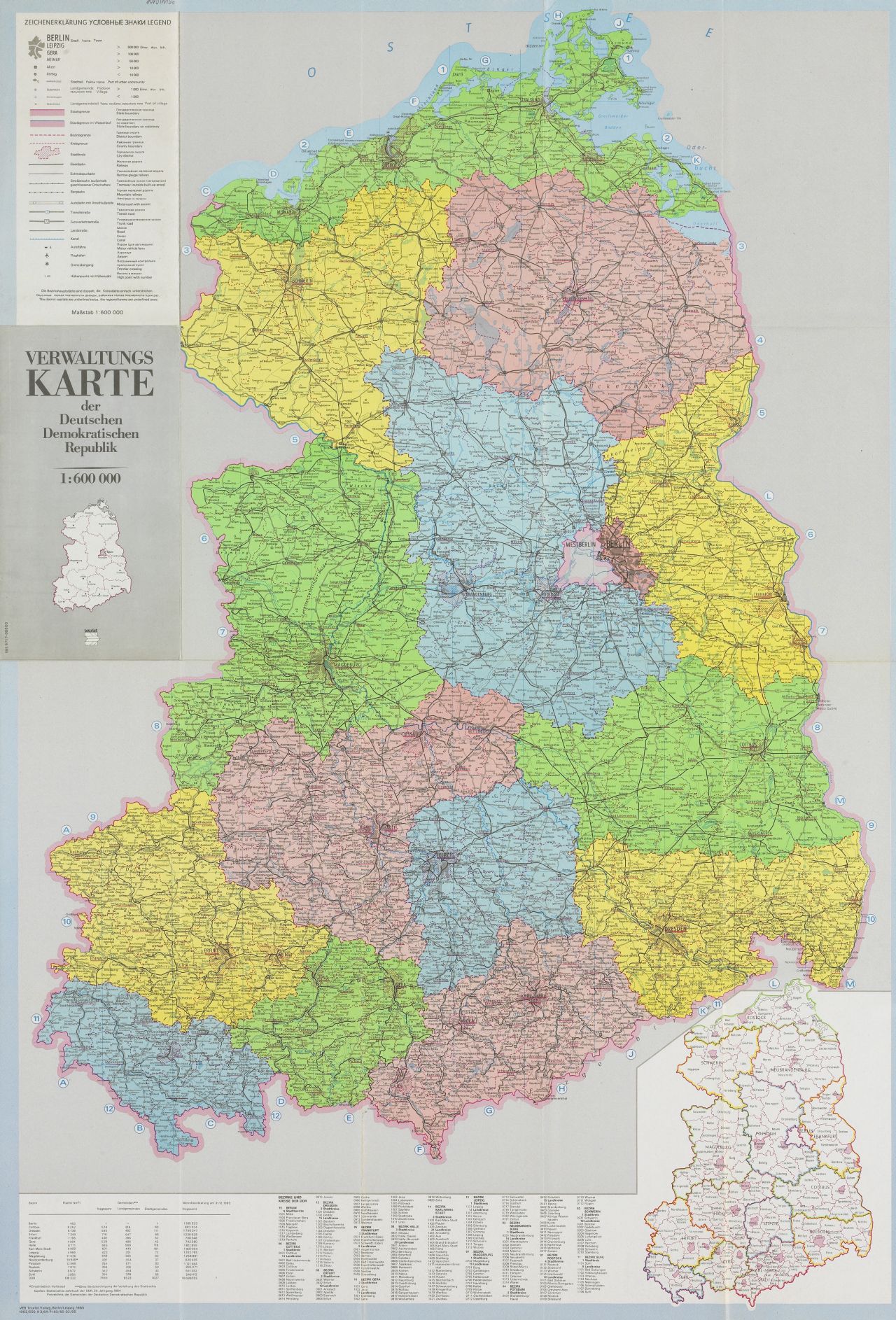
When the DDR was admitted to the BRD, the 5 new Länder's names and - roughly - their borders had already been established about 40 years before. The Soviets organised their occupation zone in 5 Länders - Mecklenburg, Sachsen-Anhalt, Brandenburg, Sachsen and Thüringen. Here's a map comparing them to their modern counterparts. [1] The red lines indicate the modern borders, the purple ones are for 1947. Quite similar, isn't it? These states were never formally abolished, but they were eventually stripped of most of their competences, beginning in 1952, when a law concerning "The Further Democratisation of Structure and Functioning of the State's Bodys in the Länder" created 14 "Bezirke" (districts), who would form a much more centralised system of government - true to the ideal of "democratic centralism" as propagated by Lenin. The DDR's second constitution in 1968 didn't mention the Länder anymore. [2] Map of the new districts.
In 1990, the Länder were reestablished, though with revised borders. As the states largely continued long-standing territorial traditions - with Brandenburg corresponding to the former Duchy and Prussian province, Sachsen-Anhalt to the Prussian province Sachsen - the Land Sachsen being the nucleus of the former Kingdom of Saxony - this solution was mostly supported by the populace. Mecklenburg was formed from the former duchies of Mecklenburg-Strelitz and Mecklenburg-Schwerin while Thuringia had already been a land in the Weimar republic.
That does not mean there was no dissent. This Spiegel article from 1990 (German) [3] lists some contentious points:
The Kreis (County) of Heiligenstadt, having been added to Thuringia after the war, applied to join the West German state of Niedersachsen. It's still part of Thuringia, and no longer a separate County.
The Sorbs/Wends, a Slavic minority in Lusatia, didn't wish to once again be split between Sachsen and Brandenburg. They had no success.
Halle and Magdeburg, the two largest towns of Sachsen-Anhalt competed for the status of capital - today it's Magdeburg.
There was (and still is) talk of combining Berlin and Brandenburg. However, Berlin itself still depended on economic assistance and was not trusted with supporting impoverished Brandenburg.
There was talk of seizing the moment to combine the Northern Länder to form a giant Nothern state ("Nordstaat") - didn't happen.
[1] https://upload.wikimedia.org/wikipedia/commons/c/c7/Germany_Laender_1947_1990_DDR.png