I am wondering how a Roman army would have marched from the garrison at Carnuntum through to Rome (following the march that Septimus Severus did to claim his position as Emperor) Did they know about Eastern passes through the Alps or would that have marched to the Via Claudia Augusta and followed a more well trodden path?
Thanks!
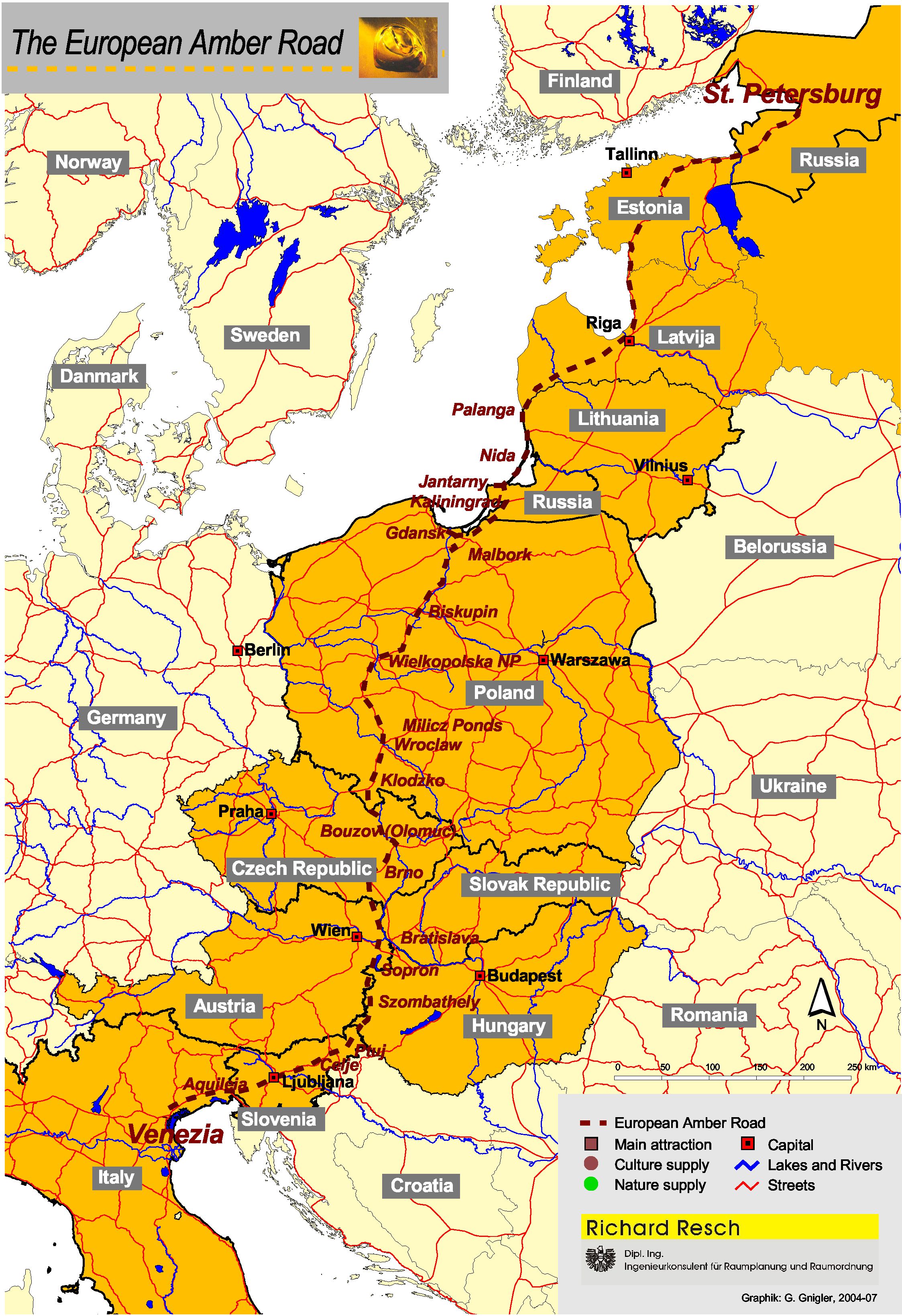
Carnuntum was founded along a very ancient trade route, the so-called (eastern) amber route or Bernsteinstraße. It was named thus because it allowed easy access from the Mediterranean to the Baltic through Carniola, the Pannonian Basin and Bohemia, bypassing the Alpine Passes. The importance can be traced down to the Neolithicum, and was evident in Roman times as well.
From Carnuntum, the route passed south through Scarbantia (Ödenburg), Savaria (Szombathely), Poetovio (Ptuj), Celeia (Celje) and Emona (Ljubljana) until it reached the Mediterranean at Aquileia. Here is a map of a possible course of the Amber Road. Inside the Roman provinces of Pannonia superior and Noricum, and the Italian region of Venetia et Histria, this road was expanded and built up in the Roman fashion, which allowed for the quick and easy transport of wares and marching of legions. The importance of Carnuntum as a crossing point (which made it become a big legionary camp with a sizeable town accompanying it) stems from this position. You can follow the course of the Roman roads on this excellent map, for example.
The Road leading south from Carnuntum has been partially excavated, and several milestones marking this important connection survive to this date.