When looking at a US population density map, there seems to be a clean cut vertical line running from San Antonio Tx to Fargo ND. With a few exceptions, there's absolutely nothing west of that line until you hit the west coast.
http://www.learnnc.org/lp/media/uploads/2010/02/usa-2000-population-density.gif
Take Lincoln Ne. Travel east on I80 you hit a major city every couple hours from Omaha, Des Moines, Cedar Rapids, Chicago, etc. Go east and you have nothing. Absolutely nothing. til Salt Lake City.
This split does not exist in Canadian population density graphs however so I'm concluding it's not a geographical divide.
Was there a specific element in US history which stopped people from moving any further west and gives that particular line of longitude any importance?
It is a combination of time people (Referring to European/White settlers, rather than Native Americans) have lived there and the terrain. Keep in mind a lot of this explanation also is pertinent to the Midwest - I am a bit biased in my knowledge, being a good midwestern boy and all.
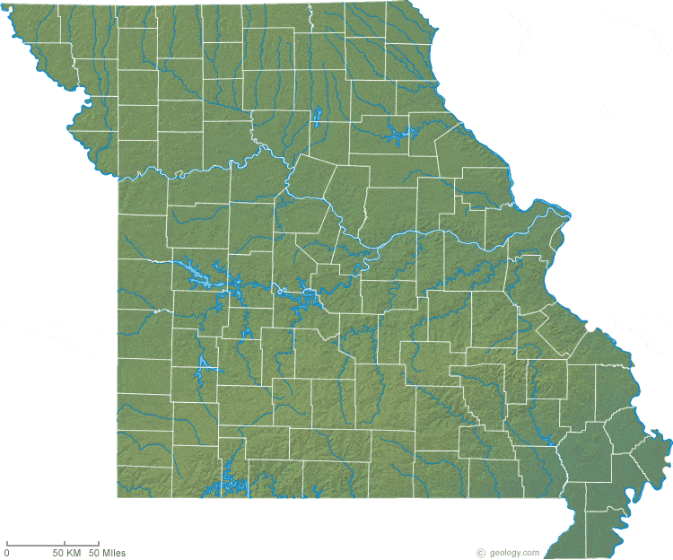
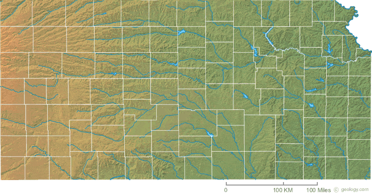
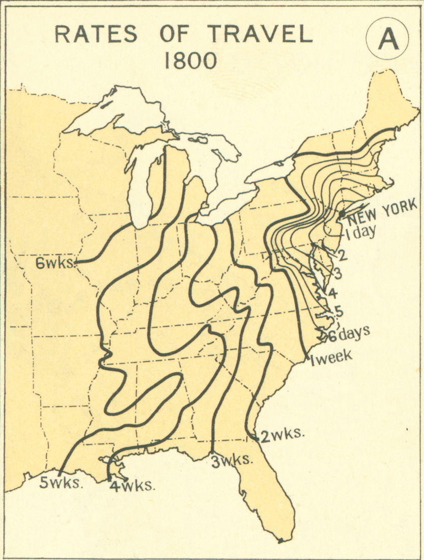
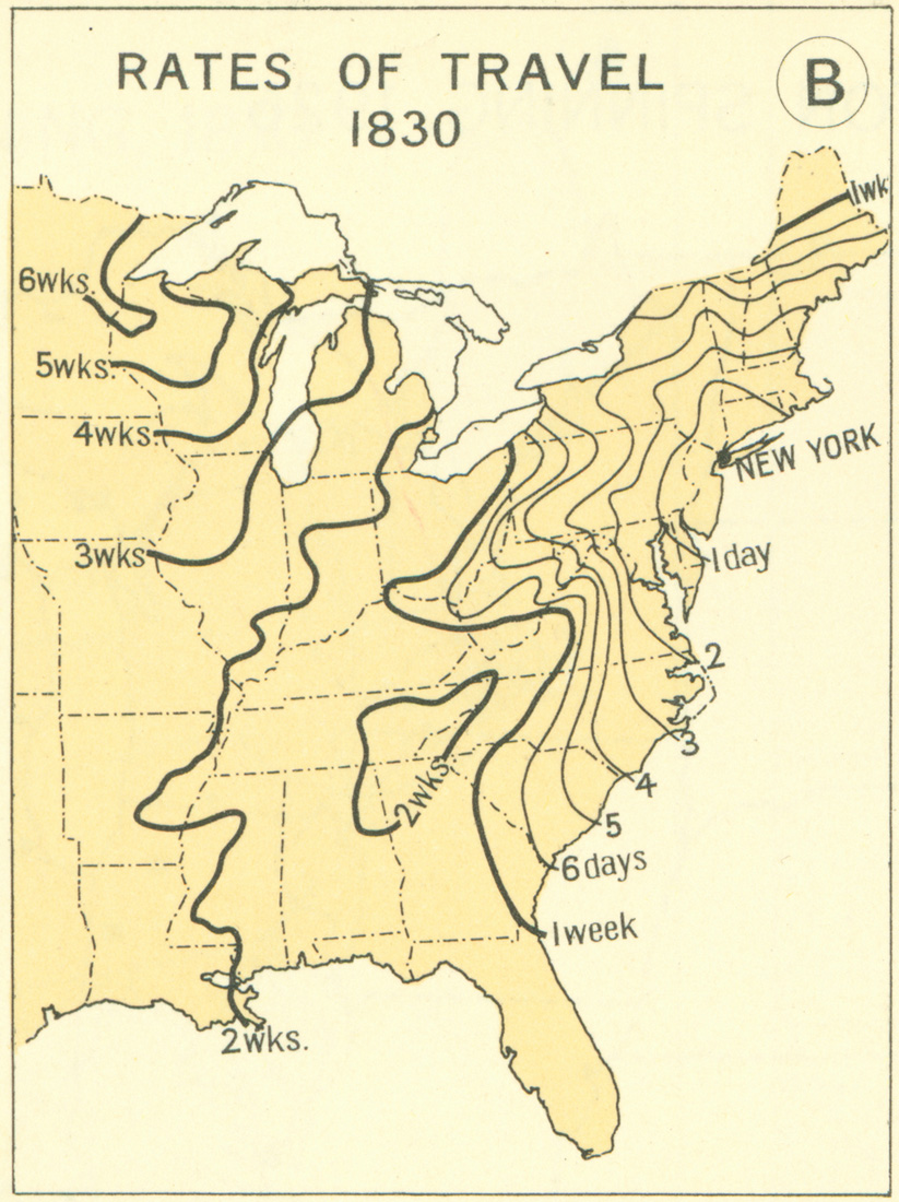
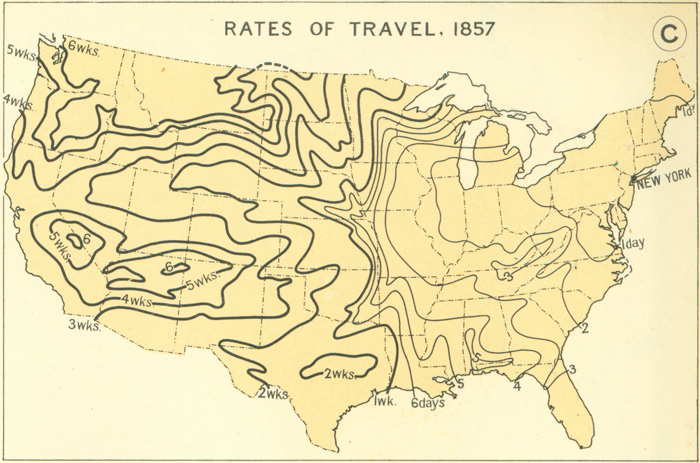
Lets look at Missouri and Kansas. Missouri^1 is covered in large interconnected rivers like the Mississippi River that borders it to the east, which the Ohio River (Which ironically starts near Pittsburgh, PA) flows into. Contrast this with Kansas^1 and you see a much different picture. As shown on your population density map, a lot of Kansas's population is concentrated on the same rivers that start or flow through Missouri. What does this all mean? Well before railroads and cars, Kansas is a hard place to get to. How hard? Well starting from New York, here is how long it'd take you to get not even half way across America in 1800^2, lets look at 1830^2, and finally 1857^2. Even if those numbers aren't the most accurate, they still show a pretty decent idea of how long travel took before the railroad. In 1800 it'll take you 5 weeks just to get to the Missouri border from New York. Start in 1857 and it takes you only 6 days to get to Kansas! So people went to places you could go to quickly, like Missouri because it is right on the Mississippi - a trip straight up from New Orleans or down the Ohio River.
So all of that factors into the next thing - the amount of time people have been living there. The first permanent (white) settlement in Missouri was founded in 1750 and has a population of about 4,400 people as of 2010.^3 The first census conducted in Missouri, in 1810, recorded ~19,700 residents, the next one in 1820 recorded ~66,500 residents. By 1860 Missouri had a population of ~1.18 million people^4, the same year Kansas had their first census conducted and recorded a population of only ~107,000 people.^5. Now there were other factors that led to Kansas being delayed in settlement, such as the US government designating the region as "Indian Territory" and closing settlement until the mid-early 1800's when they passed the Indian Removal Act^6 and opened the region up to white settlement but it, along with the rest of the West, are a similar story in regards to hostile terrain making the region hard to get to so nobody goes there. Contrast this with the eastern seaboard having constant European presence since 1607 when Jamestown was founded, which continued to grow into 31 million people by 1860^7 who were easily able to get around through the already established infrastructure in the east, and the myriad of rivers.
So finally why is California and the western seaboard a different story? That I'm not an expert in but my limited understanding is that it is because of 3 things - the California Gold Rush, the Transcontinental Railroad and Asian immigration. But hopefully someone more well-versed in California settlement history can answer that.
[1] - Geology.com Missouri and Kansas state physical maps
[2] - 'Atlas of the Historical Geography of the United States' courtesy of railroads.unl.edu
[3] - Missouri Digital Heritage, 'Timeline of Missouri History'
[4] - 1980 US Census Records, Missouri
[5] - 1980 US Census, Kansas
[6] - Kansas Historical Society, 'Settlement in Kansas'
[7] - 1860 US Census