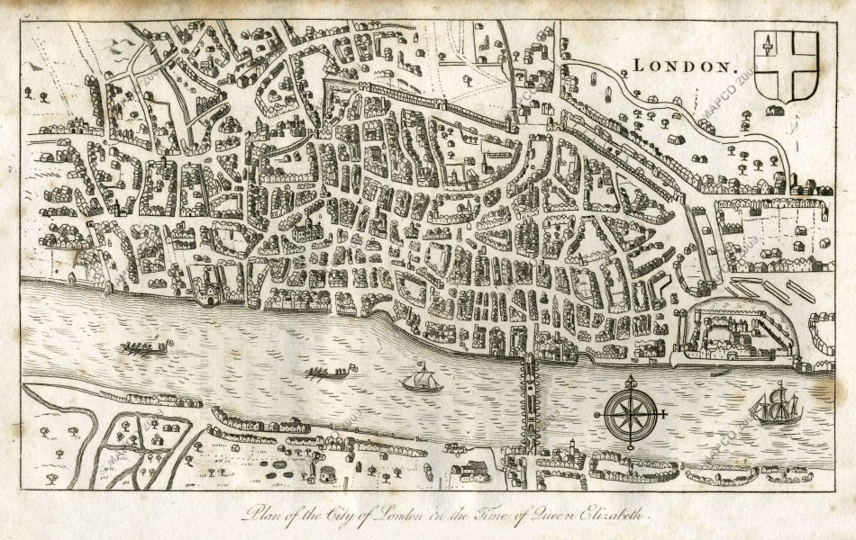
Looking at this map of London from 1593 there was something I found odd. Many of the groups of houses are essentially rings or boxes around empty space. Was this intentional or just a misrepresentation of spacing? What would go in those areas if they were actually there?
Here is one from a few years ago that explains why many European cities have similar blocks today, but the answer by u/UrbisPreturbis only traces them back to 19th century: