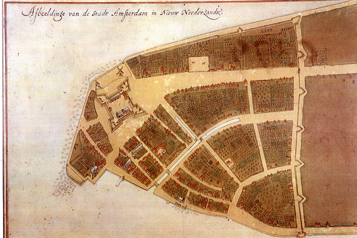
If you include mapmakers, absolutely. For instance, here is what is known as the "Castello Plan" map of New Amsterdam in 1660. It was drawn by the Surveyor-General of the colony, Jacques Cortelyou, and thought lost until it turned up in an atlas in Italy around 1900.
The map depicts all the buildings in New Amsterdam at that time, and since most of the land deeds from the mid-1600s also survived, historians were able to piece together who lived where using the deeds together with the drawings of the houses on the map.
Quite obviously, it would be impossible to actually see Lower Manhattan from that angle in 1660, but later aerial photography proved the accuracy of the land form. (Note that North is to the right and South is to the left in the linked image.)
Maps are a good example but I guess the intent of the artist here is to show where things are relative to one another.
Now I wonder if there were paintings/drawings that depicted a more realistic scene where the artist's intent was to show what the location looked like from a different angle rather than for purposes of mapping out where things are.