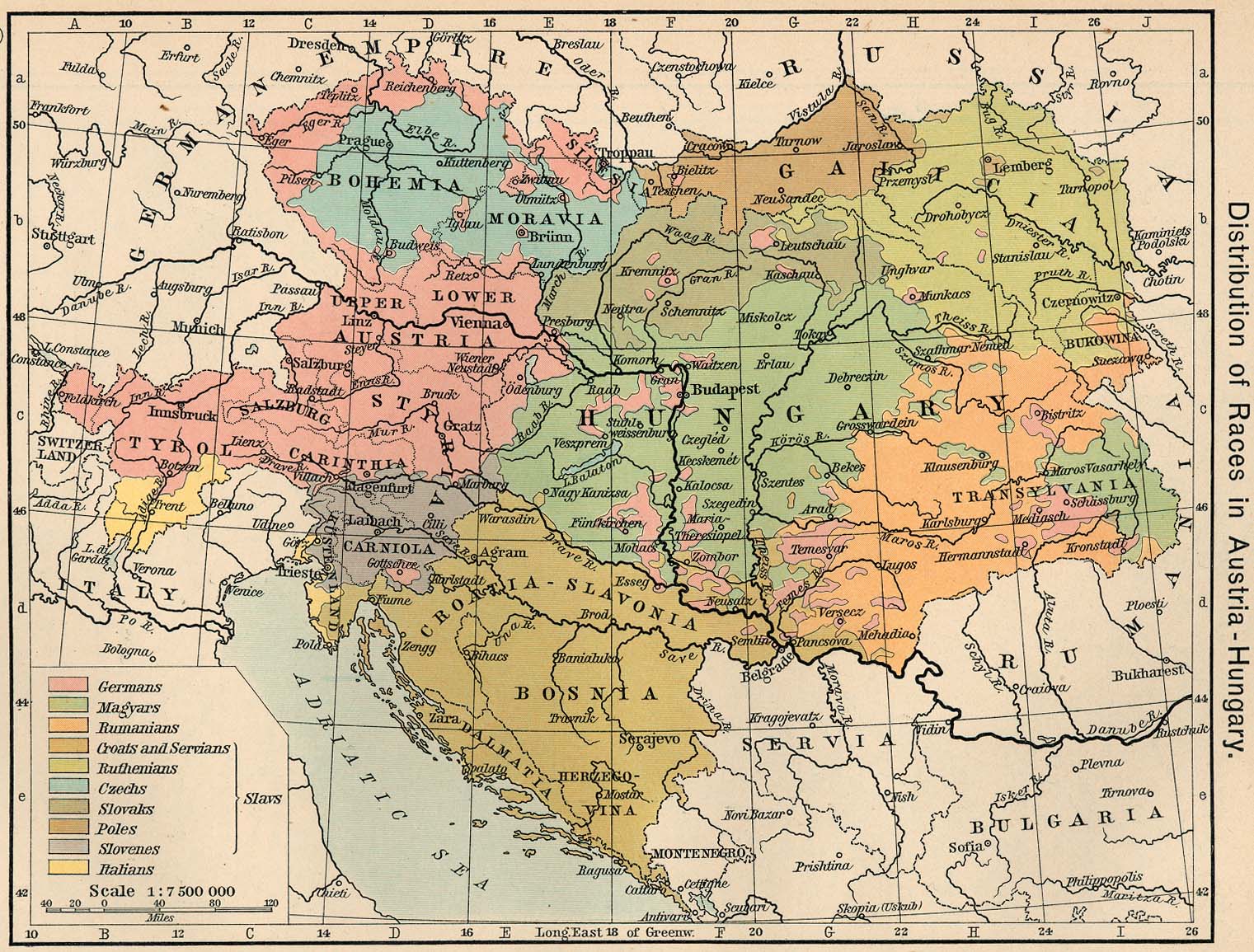
http://www.lib.utexas.edu/maps/historical/shepherd/austria_hungary_1911.jpg
This is a map called Distribution of Races in Austria-Hungary, from The Historical Atlas by William R. Shepherd, 1911. It is quoted in every single text about Austro-Hungary and the Hungarian population after the treaty that broke it apart. None of the texts doubts it, and none mentions what are the sources behind it.
What polls, surveys, research or anything went into this map, that has now solidified itself as an absolute fact, and is less doubted by naysayers than evolution and even the spherical nature of our planet.
There was a census published in late 1910 which is most likely the basis for the map. It seems to have been based on language, not actual ethnicity (note the lack of Jews).
There's also "Geographischer Atlas zur Vaterlandskunde an der österreichischen Mittelschulen" by Rothaugs.
And there were previous maps with similar information:
https://commons.m.wikimedia.org/wiki/Atlas_of_Austria-Hungary
A source mentioned in the "acknowledgements", is Putzger's Historischer Schul-Atlas:
https://commons.wikimedia.org/wiki/Category:Putzgers_Historischer_Schul-Atlas
And all of this seems to be based on Austro-Hungarian censuses. Could probably use a bit of modern verification, but there's nothing inherently suspicious about it.
Here is the link to the index of the atlas in question, btw:
http://www.lib.utexas.edu/maps/historical/history_shepherd_1911.html