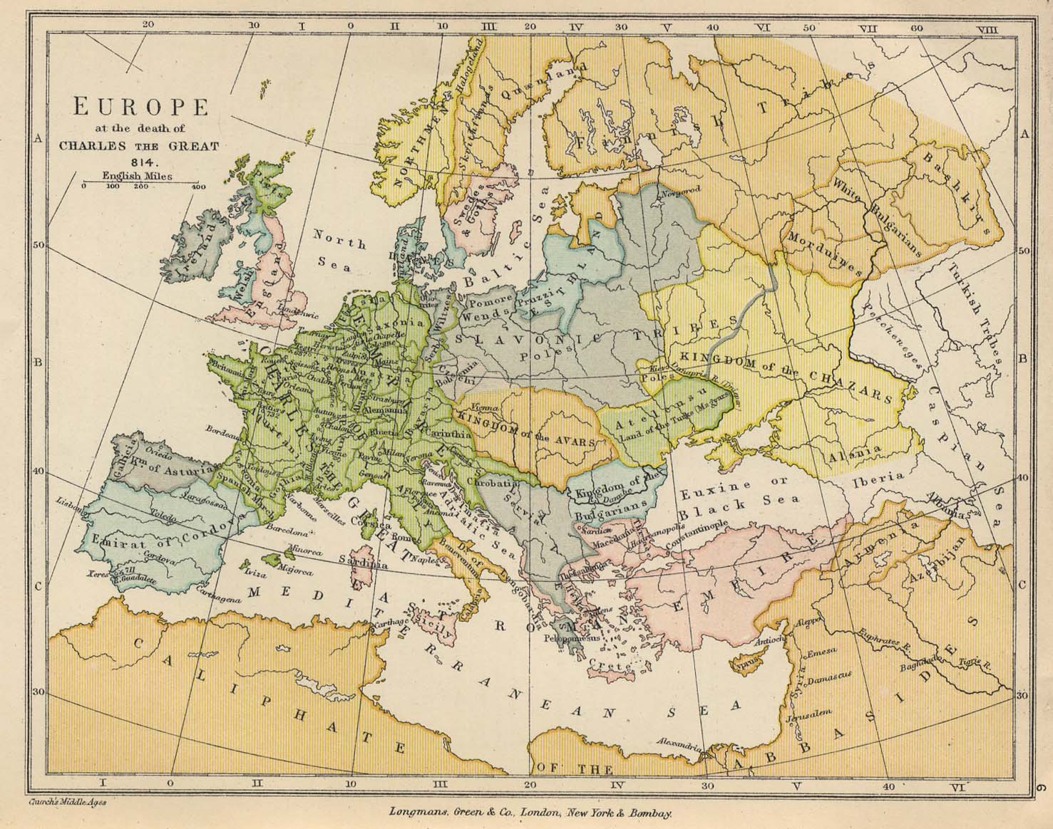
I can't find any useful information on it, but the interesting things about it are that 1. Albania is located near the Caspian sea (east of Iberia and Armenia) and 2. Serbia (Servia) is much larger than it is normally thought in that period, and if we take into account the fact that there was no people named Bosniaks, Montenegrians or Macedonians, does that mean that this is some precursor to the later Serbian kingdoms, empires etc.? Btw, this isn't a "homework" question, just interested in possible explanations.
EDIT: was going to say, especially since the first mention of the word "Serb" was in 822., officially.
The boring answer is that its not an accurate map, or intended to be one since its from an atlas for schoolchildren from 1905. From the preface:
The principles which have been followed are mainly two-never sacrifice clearness for the sake of detail, and to let each map deal with one period only; in short, we have aimed at telling one story at a time and at telling it graphically in clear and easily-remembered outlines.
You can see how this map would be to illustrate the "story" of the domain of Charles alone, with vague or incorrect detail everywhere else.
As for Albania being in the Caucasus, I believe the map says "Alania" and is probably referring to the Alans, speakers of an Eastern Iranian language who did indeed live in the Caucasus in the Early Middle Ages. Some Alans were among the various ethnic groups invading the late Roman Empire, but not all participated in this migration. The modern-day Ossetians are thought to be the descendents of the Alans and still exist as an ethnic minority, mainly in Russia and Georgia (There was a war about it you may remember, back in 2008)