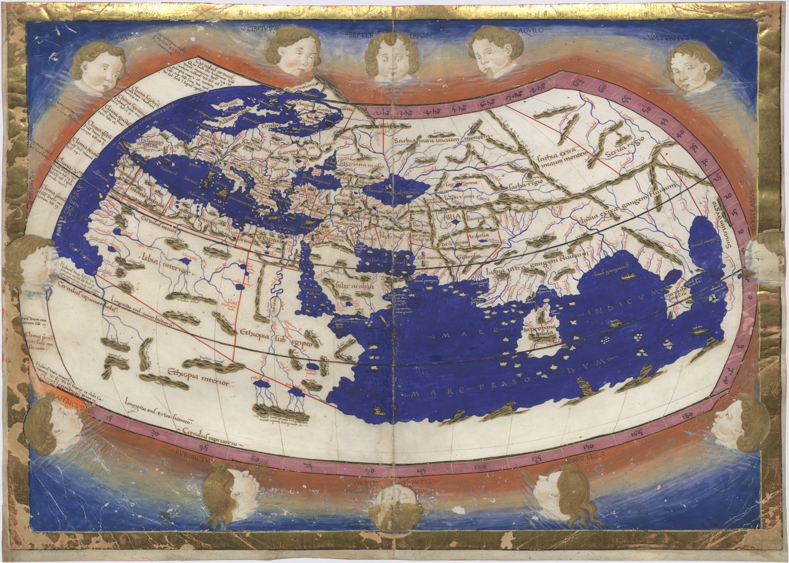
In an old post by /u/Itsalrightwithme, he mentions that Ptolemy had measured the landmass of Eurasia and Columbus thought it was actually shorter. How did Ptolemy measure the width of Eurasia? Or I am misunderstanding the post.
The post is at: https://www.reddit.com/r/AskHistorians/comments/3vo2xj/did_christopher_columbus_really_think_he_landed/cxpakst/
EDIT: also what units was the circumference of the Earth measured in, as meters had not been invented yet.
I am guessing that /u/Itsalrightwithme made a lapsus calami or something like that, because strictly speaking, Columbus thought the span of Eurasia is much larger (he placed the span at ~260°for the continent plus Cipango/Japan additionally further 30°), while Ptolemy placed span of oikoumene - the known inhabited world - at shorter value 180°. However it is important to know that to Ptolemy, oikoumene was not strictly the equivalent for Euroasia! If we analyze some of maps made by his data (13th century, or 15th century we will quickly see that Ptolemy's maps of the oikoumene at their eastern and southern limits end with land, not oceans, indicating in Ptolemy's vision they could theoretically extend further east or south. He just didn't plot them as it didn't fit his vision and he had no information about them.
This bring us indirectly to the way Ptolemy gathered his data. He claims to have calculated some data (like latitude of some places) but mostly he compiled a thorough and skeptical analysis of previous work and data of various geographers, astronomers (like Eratosthenes, Hipparchus, especially Marinus of Tyre) and consulted various itineraries, travel logs and tales he could find, after contrasting it with other data. Of course, astronomical data was only for latitude, as measuring longitude was a problem that wasn't cracked till the 1700s.
With that considered, his data is thus in some areas relatively correct (for example his Egypt, Levant and Greece are okay), some are relatively similar but distorted (e.g. Britian and surprisingly Italy, which have East-West distortion) and some really bad which happens to be the case for most of his Asia.
Simply put, Ptolemy compiled his measurements from various sources, but other then the locations he and his few predecessors could reasonably well measure the rest of the world was built on estimates and guesswork, and as such was gravely distorted. And his estimate for Asia is one of those, and we could only take it as an educated guess, rather then a "measured" value.
Finally, your question on the units. The ancient Greeks used their own unit "stadium" or "stade" for expressing length. It's value fluctuated and actually gives much trouble to historians even today. At Ptolemy time though it was mostly assumed to be 1/8 of roman mile, making it around 185 modern meters. Romans used miles, which were around 1485 modern meters. In medieval times, mile was the unit used, and Italians like Columbus used miles which were around the same as Roman miles or 1485 meters. Arabs on the other hand used longer miles which were between 1800 and 2000 meters.
Medieval scholars continued to use miles, but in various important geographical works of the Middle ages the values for circumference were taken from ancient authors and simply provided in stades as found, leaving the question on how to convert stades to then current mile open and source of much frustration and mistakes.
For more information on circumference, span of Eurasia, and Columbus I recommend my own post about theories about the circumference of the Earth in time of Columbus