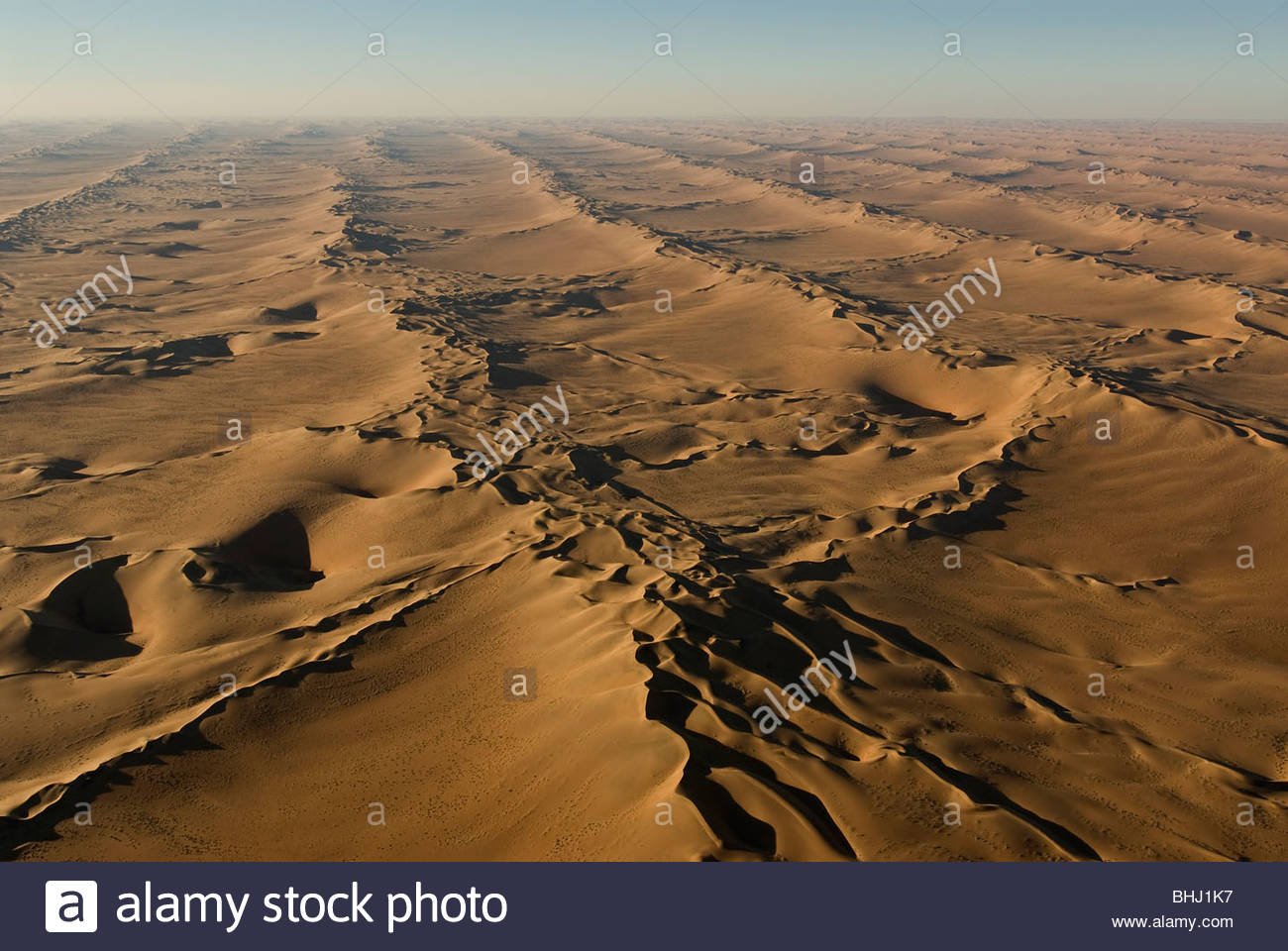
Throughout Namibia, Botswana, and Angola there are what looks to be remnants of ancient canals on a massive scale (some still in use perhaps?).
Since some changes in imagery "go past" current rivers they seem like they are ancient, but I'm not sure really what to think. It looks as if some haven't been in use for thousands of years. You can see what I assume are rusty iron deposits staining the landscape.
The following maps show a few of the areas, but do scroll around and look - it is absolutely massive!
https://www.google.com/maps/@-18.3017391,18.6376402,116654m/data=!3m1!1e3
https://www.google.com/maps/@-18.8502375,21.2818586,85332m/data=!3m1!1e3
https://www.google.com/maps/@-18.0697654,17.5602567,85192m/data=!3m1!1e3
https://www.google.com/maps/@-21.2053734,19.9373484,43821m/data=!3m1!1e3
(with RES for me these are too zoomed in, so zoom out a little bit until you see the lines)
What are these and who created them? How far back do they go? It seems like an absolutely massive construction project but I've not been able to find out anything about them. Thanks!
You appear to be getting this from the Time-Life Mysteries chunk of the Internet, where I'm seeing lots of gushing about ancient irrigation systems in the Kalahari. (Representative example here.)
Go a little deeper than Google Maps, here- you're looking at one low-resolution photograph. The problem is magnified in Google Earth, because these features are smoothed out by algorithms meant to create 3D images of human streets and buildings- they're going to suggest a world full of more polygons and straight lines.
What you're looking at is the Kalahari Desert, and the Kalahari is full of - everyone say it together - SAND. Sand, when blown by consistent winds from one direction, forms dunes. These dunes take on a rhythmic, linear appearance. I could go on, but I'm going to go straight to a source which also relies on aerial photography - this page from NASA's website.
...NASA's Terra satellite captured this image on May 7, 2007... the long, thin diagonal stripes are linear dunes.
So what you're seeing are not shadows within canals, but shadows cast by tall dunes.
Fascinatingly enough, you have accidentally stumbled onto a mystery; the dunes didn't make sense given wind and vegetation patterns in the Kalahari. According to NASA, researchers in the 1980s and 1990s drilled into the dunes and found that they likely formed between 28,000 and 10,000 years ago, and enough vegetation now survives to hold their shape largely intact.
So, this is a fun exercise which shows us a few things.