What did the authors of this major 16th century atlas use for sources on the cities they illustrated? Of particular interest to me is the view of Calicut, where a presumably Chinese vessel is shown in the foreground alongside of a presumably Portuguese nau. Did anyone involved in this work travel to the cities described here or did they work off of written accounts or older illustrations?
Bergen in Norway and Stockholm in Sweden had engravings signed by a Hieronymus Scholeus, about whom little is known. Norwegian research by August Brinkmann Jr. (Hieronymus Scholeus' Bergens-prospekt – en analyse , 1973) found a letter from Henrik Rantzau (who'd supplied the Scandinavian images for Civitates ) to king Frederik II of Denmark-Norway showing that Scholeus had indeed visited the places he'd sketched, and also discrediting an older theory that "Scholeus" had been a pseudonym for Rantzau himself.
These are locally well-researched because of their historically significance; it's the first reasonably accurate image of Stockholm (Vädersoltavlan is older but not so realistic), and it's the oldest known image of any sort for Bergen. Scholeus is also assumed to have done Helsingør and Ribe (Ripen) in Denmark, although those images aren't signed.
So in those cases the images were originals. (and would be much copied later)
Civitates orbis terrarum was a masterpiece atlas compilation of text and maps and cityscapes made edited by Georg Braun and engraved mainly by Franz Hogenberg with also some works mentioning Simon van den Neuvel as additional engraver working on the projects. The copper engravings were based on either existing originals - some made by the authors, some taken from other artists; or were commissioned specifically for this book.
For example of "borrowed images", here are some clearly modeled after Anton van den Wyngaerde's paintings:
Genoa - Civitates and Genoa - original
Barcelona - Civitates, Barcelona - original
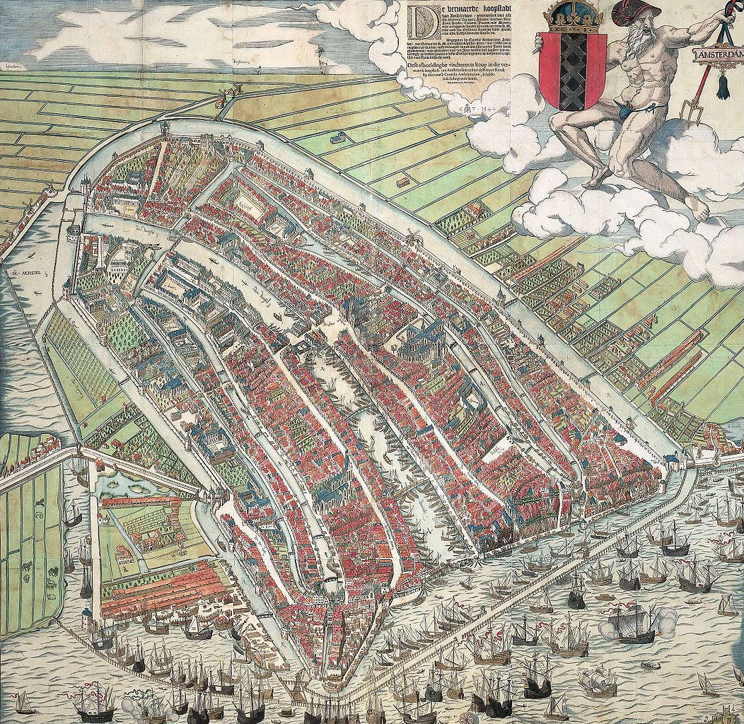
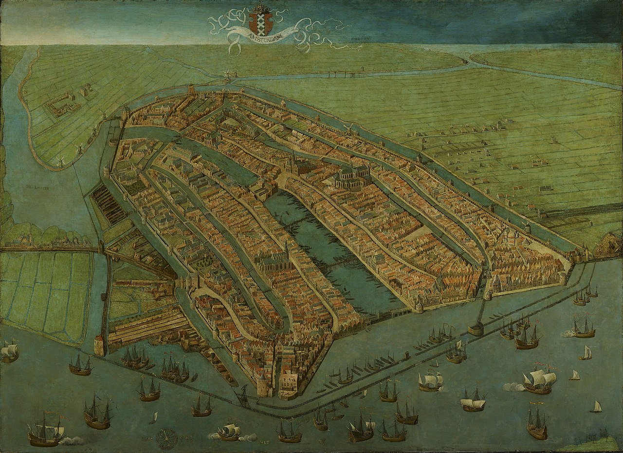
Amsterdam in Civitates was modeled after Cornelis Anthonisz's woodcut of 1557 based of his own painting of 1538
But majority of others was made by few select authors. Either by Braun&Hogenberg themselves or from few authors who already made such compilation or whom they hired to more. Most notably images are fashioned by or after Georg (Joris) Hoefnagel and later his son Jakob, then Jacob van Deventer.
Following the first editions of the book, many people began sending images themselves, which Braun and Hogenberg gladly incorporated. Johannes Keuning writes in his article The "Civitates" of Braun and Hogenberg:
Not only did the reading public hold the work in high esteem; it proved its interest by attracting contributions. Heinrich von Raitzau, living at Breitenburg in Holstein, sent the publishers several views of places in Schleswig, Holstein, and Denmark. Gerard van Groesbeeck, bishop of Liege, "liberalissime communicavit" the beautiful view of Liege. Doctor Remacle "perhumaniter" supplied the views on Lim- burg and Hoey. The prebendary Musines "perbenique" offered the view on Namur. Simon a Belle Monte (de Beaumont?), sacellarius of the church of St. Servaes in Maastricht, procured a view of this city ("sua industria et penicille expression"). Adam Wackendorf, clerk of the Hanseatic League in London, sent the publishers the view of Danzig. And so on. But in most cases the names of the persons who supplied the original pictures remain unknown. The views of Netherlands cities are, in general, imitations after Jacob van Deventer. Some artists from elsewhere are unknown, Leonard Abent of Passau (III, 46) for instance. Others are more or less well known artists, such as Hendrick Steenwijck (I, 39), Jan Vermeyen (II, 37), Pieter Brueghel (VI, 53), Egidius van de Rye (VI, 31 and 41), and Quentin van der Gracht (IV, 7). But the chief of all is Georg Hoefnage
All in all, the works came from a wide variaty of authors and we don't know the origin points of all of them.
The sad part is I could not find any information who drew Calicut and other Indian and African ports. List of Hoefnagel's contributions do not name them, so it probably wasn't him, but other then that, it's an enigma to me. The Civitates actually shows images of most Portuguese held cities overseas (plus Lisbon itself), so it is highly likely it was done by someone familiar with Portuguese Empire. Yet, as I will attempt to demonstrate, the images do not actually show real images of the cities, as for example images of Amsterdam and Genoa do, but some highly distorted images which were most likely done from verbal description rather then real eye-witness account.
Clear examples of this are towns of Diu and Goa and Cannanore appear both in Civitates and other works, and their image in Civitates is nothing like the original.
Look at Diu in Civitates and this image of Diu fort done by Correa in mid 16th century and another from 1540s. Here is also a comparison of Correa's image with moden satellite view showing that Correa's image is highly accurate, and it nor the other image looks nothing like the Civitates image.
Here is also one of Goa from Civitates and Goa from various images by Portuguese. It shows some reseamblance, but not nearly the level of the above images.
Also Cannanore (Civitates) and Cannanor (Correa)
We sadly don't have many images of Calicut, but this image of Calicut fort by Correa looks quite different from what we have in Civitates.
All in all, I would conclude that images of Indian and Asian towns displayed were not done in the same level of accuracy like images of European towns. They do show the main features meaning they weren't completely fabricated, but it's obvious they were not done on the site, and I think we should not use them to draw any conclusions or imagine that's how the towns, or other details on them, looked like
EDIT: fixed some bad links
Edit: Calicut not Calcutta that was an error on my part.