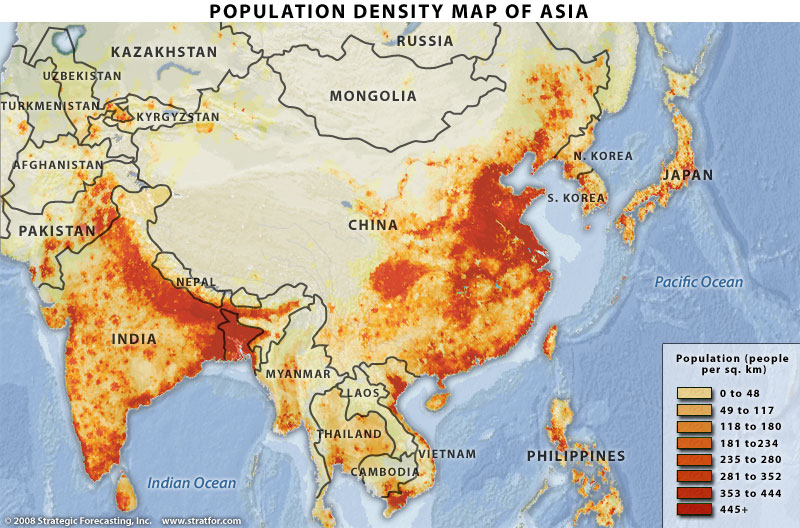
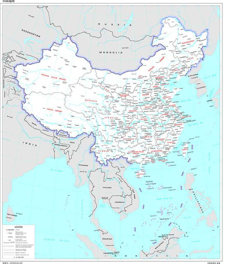
Prior responses have pointed out the absolute quantity of arable land between modern China and modern India does not diverge heavily. I wish to elaborate. If we look at a modern map of Chinese population density such as this, we see a general pattern – population is concentrated on the river systems, and particularly in the region between the lower Yellow, Yangtze and Beihe Rivers (see here), with some additional areas around the Liao river in Manchuria, the Pearl River in the deep south and parts of the upper Yangtze in Sichuan. I've taken the liberty of overlaying the two maps so you can see what I mean.
I point this out because China as a state entity has increased its borders substantially over time, primarily into lesser-populated regions off the major river systems. Contrast the maximum territorial extent of the Qin Dynasty (3rd century BC) with that of the Tang (7th to 9th centuries AD), that of the Ming (14th to 17th centuries AD) and finally that of the Qing (17th to 20th centuries AD) and you will notice that while there's a lot of new territory, barely any is densely populated outside the Liao basin. Indeed, if you have a look at a (slightly quickly slapped-together) overlay of Qin territory with a modern population density map here, you will see that in fact the majority of densely-populated regions of modern China have been encompassed by the Chinese empire from the beginning. The additions, with the exceptions of the Pearl and Liao basins, have generally been relatively low population density, such as Tibet, Kokonor, East Turkestan and Inner Mongolia. As such we're generally – though obviously not entirely – looking at a Chinese population still predominantly concentrated in the same areas.
(Yes, the Qin map includes Taiwan. Yes, I'm annoyed, too.)