Here is a map of Scandinavia, courtesy of Google Maps:
As you can see, Norway has some interesting borders. People tend to think of Norway as the westernmost of the Scandinavian countries, with Sweden and Finland farther east. But in fact, you can see that Norway actually wraps completely around the northern tip of the European continent. Thus, there are parts of Sweden, Finland, and even Russia that have rural Norway as their northern neighbor. This makes Norway the westernmost, northernmost, and easternmost of the Scandinavian countries.
I'm cynically thinking there's no way that this was an accident. I'm sure Norway must have intentionally tried to deny access to the Atlantic Ocean to Sweden and Finland by claiming a tiny sliver of coastline. Was there some strategic significance in doing so, like they wanted to control all the ports? Did something happen to make Norway not believe in equity, and they wanted Sweden and Finland to only have the Gulf of Bothnia and the Baltic Sea for ocean access?
No, they did not. In any way.
Waterways were, until the last 150 years or so, the main means of transportation; rivers, fjords, lakes and seas. The Scandinavian population spread primarily along the coasts and along waterways. Norwegians spread up along the coast, because the Gulf Stream gives those areas mild winters compared to inland areas, particularly on the other side of the mountains that separate Sweden and Norawy. Tromsø has average winter lows at -6 at the lowest; Kiruna, 200 km south on the Swedish side averages -19 C, colder than the record low in Tromsø.
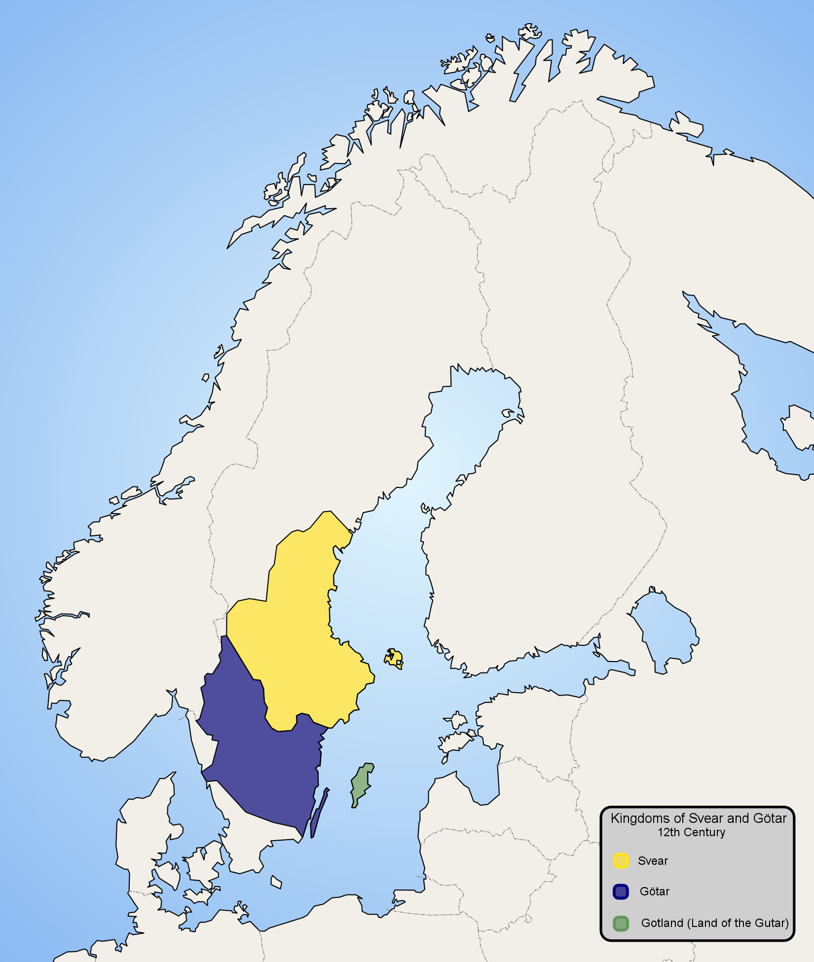
The mountainous border region was and is extremely sparsely populated; event today there's not a town (stad) within 100 km of the Norwegian border north of Karlstad. The small inland populations that did exist mainly transported their goods up or down the rivers or fjords to the coast; out to the Atlantic in Norway and down east to the Baltic in Sweden, not across the roadless wilderness and mountains. With the exception of Jämtland, Idre and Härjedalen, which are now-Swedish regions on the east side of the mountains, which had closer ties with Norway due to geography. These became Swedish in the 17th century, as did Bohuslän on the west coast. The resulting border today largely follows the drainage divide, where areas that drain into the Baltic are Swedish, as well as the areas that drain into Göta Älv on the west coast, which constitute the historic provinces of Västergötland and Värmland. (other than the uppermost part of Klarälven)
It had nothing to do with strategy or controlling ports. It was only in the 20th century that iron mining in Swedish Lapland and the railroad lead to the building of Malmbanan, for the transportation of iron ore from Kiruna across the mountains to the port of Narvik in Norway.
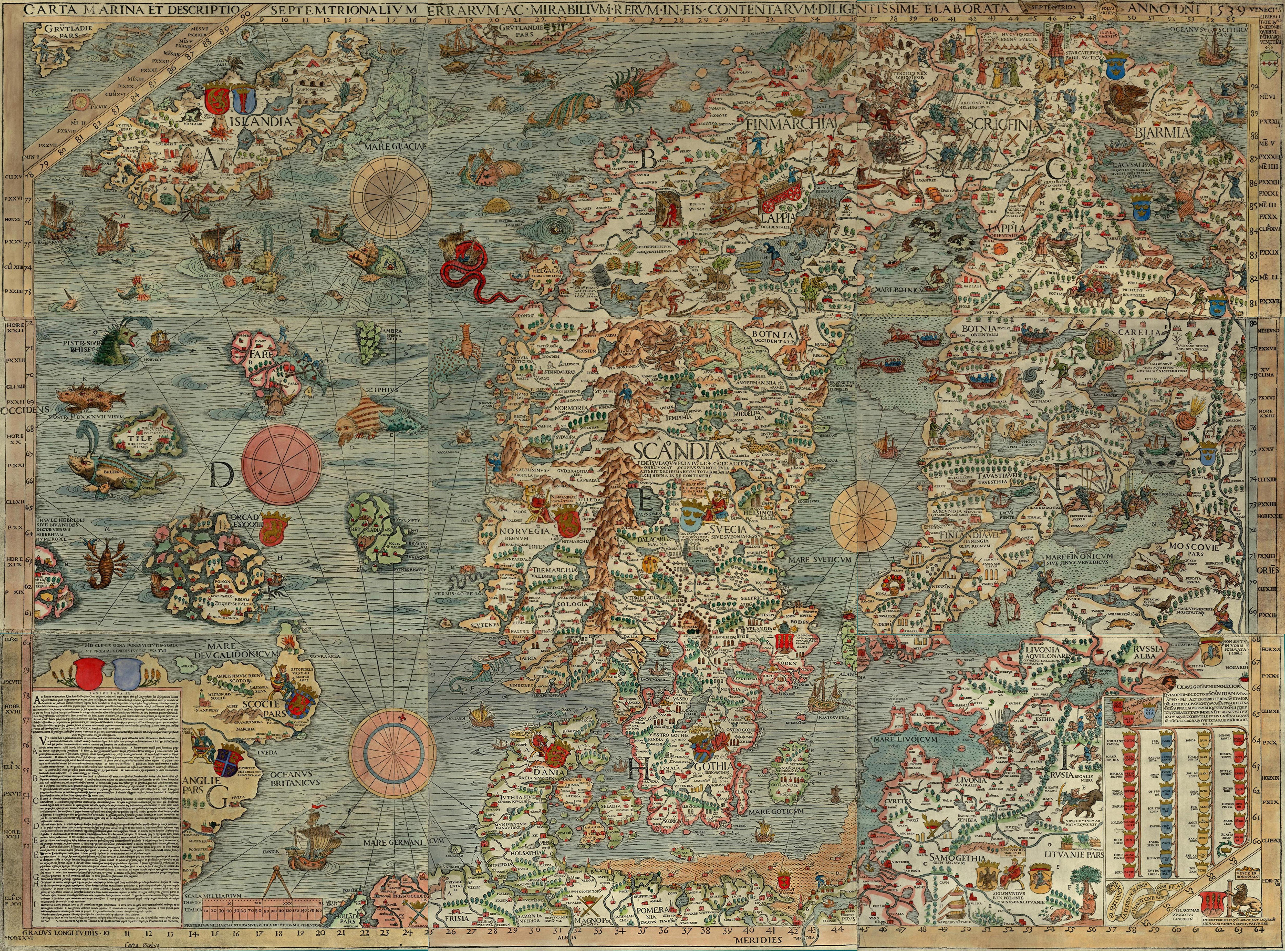
But it was not until the 19th century that inland Lapland was significantly populated by Swedes, largely due to mining, and in Norway settlement remained limited to small coastal outposts like Tromsø, which lived off fishing. Historically these are Sámi areas and the borders were not well-defined at all for most of recorded history. Olaus Magnus Carta Marina from the mid 1500s shows Sweden's claim to land up to the Kola peninsula, even though this was little more than a claim and the land was hardly under the control of any government.
As far back as recorded history, the past 1000 years, Sweden and the aforementioned petty kingdoms of Värmland and Västergötland which were subsumed into it, has had access to the Atlantic through Göta Älv. That was of strategic importance as the wealthy and well-populated province of Västergötland depended on it. During the early Middle Ages, the Swedish west coast was little more than the mouth of the river, Bohuslän north of it being Norwegian territory and Halland south of it being Danish, both of which would be conquered by Sweden in the 17th century. The mouth, with the trading towns of Old Lödöse and later Gothenburg was held by Älvsborg fortress, which was of great strategic importance but never held by Norway, although it was ransomed twice by the Danes.
Northernmost Finland also consists of an extremely sparse, mainly Sámi population. The two protruding 'arms' of Käsivarsi and Inari in the north are mainly national parks and nature reserves. But after independence, Finland did have access to the Arctic sea through what's now the Pechengsky District of Russia (Finnish Petsamo), which was taken by the Soviet Union in World War II.
To recap: Historically the Norwegian coast had no strategic importance to Sweden and Finland whatsoever. It's Norway because Norwegians settled there and claimed it. Even at its height of military power in the 17th century Sweden was entirely focused on domination of the Baltic and had little interest in conquest of Norway, although Trøndelag was briefly captured.