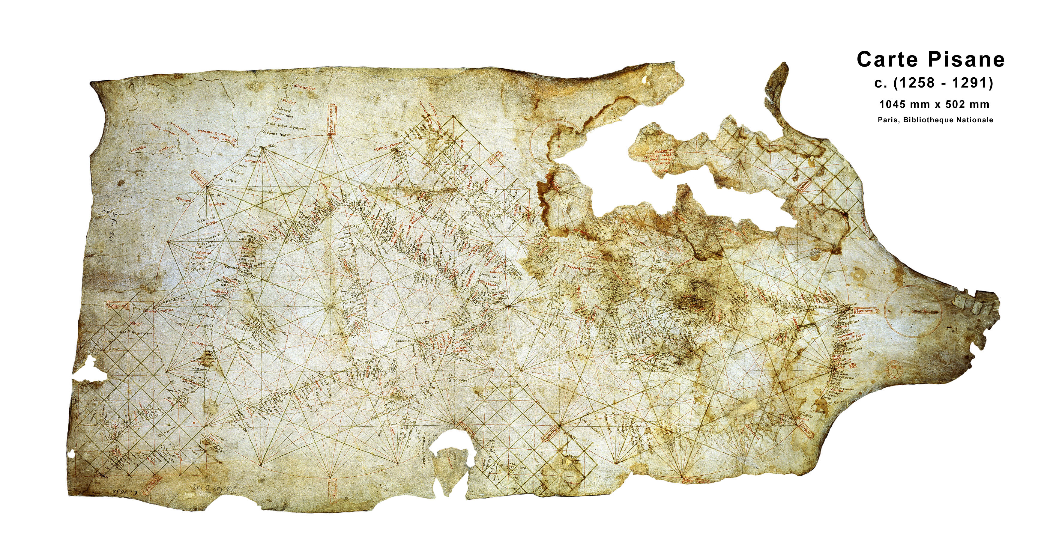
Nowadays every map I've ever seen has the north pole at the top, antartica and the south pole to the bottom, so that if I point to a part of the map, going "up" is going north, going "down" is going south, going left is west and going right is east.
Did ancient societies have maps where it was the different, where another direction was their "up" on the map and their "North" would have been our "east"?
There really isn't a single objective reason why north would be preferred. As I will show, it's simply a convention that circumstances lead to prevail over all others. And there were others.
Now, there are multiple claims why North came up on top (pun intended). I'll list the usual culprits and also the problems with them. We may give some credence to the fact that Earth revolves around North-South axis, as well as Earth's magnetic field going North-South so those two directions might be considered more important then East-West, although it still remains open to interpretation why it would be chosen to place "more important" directions up-down instead of left-right, and why would North be prioritised over South.
Some suggest it's because of the North Star an important object for astronomy that is "up" and North. But on the other hand, the Sun is probably as much, if not more, important object for astronomy and it is to the South. Others suggest it might be due to compass pointing North, but in fact, a compass can just as well point South, and it seems the initial compasses had indeed pointed South, and the reasons for the switch are even more unclear than this question. Other reasons for preferring North are given as cultural as the Greco-Roman culture we consider the origins of western cartography was in the Northern hemisphere so they presumably would put themselves "up" or "first" especially as their writing style was top-down and left-tp-the-right which would mean that it might be more fitting to put their own lands in the top-left of maps, where they would be "first" and it would be natural for them.
Now, the biggest reasons why all these theories are a little unconvincing is that there are many, many examples of maps that are not oriented north up throughout the history (I'll focus on the maps belonging to the "Western" cartographical tradition as I know very little on the others)
My knowledge of the Greek-Roman cartography is very limited but I am lead to believe that at least some of ancient geographers placed South at the top before Ptolemy's influential work placed North at top. (and we'll get back to Ptolemy shortly) Christian Europe lost knowledge of Ptolemy's cartographical work, but it continued in Arabic Islamic scientific thought which continued to produce maps in Ptolemeiac projections with one major difference - they had South at the top! The most famous example is this 12th century Al-Idrisi map. it's worth also mentioning that Arabs were exceptional astronomers and were familiar with the compass, and still kept their maps orientated with South at top contrary to the above claims.
In fact, Arabic cartographic influence could be felt in Europe too. As late as 1450s Italian monk Fra Mauro created a now-famous world map with clearly South on top. We have gone a little too far ahead in time, so let's briefly discuss earlier medieval Christian Europe which produced two kinds of maps: the symbolical so-called T-O maps which usually had East at the top and navigational portolan charts. Now contrary to common wisdom, Portolan charts had actually no real orientation we could speak of and were most likely intended to be rotated around as necessary. The inscriptions of coastal features - the integral feature of those maps - were placed in the inland part left of the coast of the sea, so often they were upside down, or rotated. E.g. if you wanted to sail near the western coast of italy, you placed North at the top, but if you wanted to go by Eastern coast, you would put South at top. Maps with legends and texts also had them all around, the best example is Catalan World Atlas whose legends and illustrations are simply orientated according to the nearest edge, and our best guess is that map was intended to be placed on a table and people would walk around it looking at it.
The important development that happened was in 15th century when Western Europe was reintroduced to Ptolemy's Geographia with translations from Greek coming from the Byzantine Empire. Now Ptolemy is important for two reasons: one is that he provides a detailed instructions on how to create maps in the first place, and the second is that he is pretty explicit about why he is orientating his map to North:
We have chosen an order [of presentation] with forethought to convenience in the drawing of the map in every respect, namely progressing toward the right, with the hand proceeding from the things that have already been inscribed to those that have not yet [been inscribed]: this would be achieved by having the more northern [places] drawn before the more southerly ones, and the more western before the more eastern, because our convention is that "up" with respect to the map-makers' or spectators' view means "north," and "right" means "east" in the oikoumene, both on a globe and on a planar map. For this reason we have first set down the localities in Europe, which we, too...
(Translation is taken from Ptolemy's Geography: An Annotated Translation of the Theoretical Chapters page 94)
According to my interpretation of this text, Ptolemy chose his orientation as it felt natural to him due to the way of writing - "going from what is inscribed to what isn't", although I think it can be still open to discussion and perhaps a more clear translation would be helpful.
The initial translations into Latin of the earlier 15th century were influential, but still not immediately paradigm-shifting. Fra Mauro, which as I said made his South-orientated map in 1450, actually references Ptolemy, and why he didn't use his North up orientation (translation taken from Wikipedia)
"I do not think it derogatory to Ptolemy if I do not follow his Cosmografia, because, to have observed his meridians or parallels or degrees, it would be necessary in respect to the setting out of the known parts of this circumference, to leave out many provinces not mentioned by Ptolemy. But principally in latitude, that is from south to north, he has much terra incognita, because in his time it was unknown"
However, after the invention and spread of the printing press, Ptolemy's work was widely disseminated and took as the foundation of cartographical science. Especially in places like Germany and northern Europe which didn't have a portolan chart culture. We have an example of Martin Waldseemüller making maps in Ptolemaic style.
To again showcase the arbitrariness of the whole process, we still have Western European schools of cartography not following the orientation of North up, namely [French Dieppe maps](https://commons.wikimedia.org/wiki/File:Guillaume_Brouscon._World_chart,which_includes_America_and_a_large_Terra_Java(Australia)._HM_46._PORTOLAN_ATLAS_and_NAUTICAL_ALMANAC._France,_1543.jpg) where we can find plenty of experimentation with orientation and some with explicitly South up top orientation.
The final acts that cemented North up orientation were works of Abraham Ortelius and Gerard Mercator whose exceptional contributions and improvements on the Ptolemaic model pretty much set the standard as North being up top and maps as we know them today.