I know relatively little about this, but wikipedia tells me Carthage was totally destroyed by Roman forces in 146 BC.
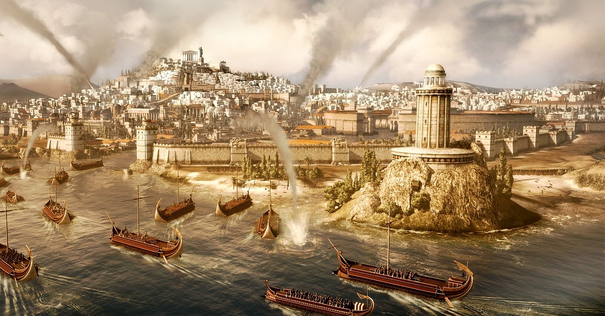
When I look on google to try and find recreations of what Carthage might have looked like, I get images like this.
Is there anyway for us to know what Carthage would have looked like, or is this all fictional guess work? Do we know anything of its monuments? How did its grandiosity compare to that of Rome prior to its destruction? Are there many/any written descriptions of the city from the time?
Carthage was a major Mediterranean city in the 2nd century BCE, perhaps one of the top cities as far as ornament and sophistication, if not population. We don't know everything, but archaeology has given us a pretty clear picture of the city as it was in the decades before 146 BCE.
The most obvious feature of the city would have been her massive sea walls, especially along the sea front facing east, where in some spots they reach 5 meters thick. Recent German excavations have shown similar major fortifications ringing the inner city to the south, as well, and we should probably assume a nearly-complete circuit. The sea walls were finished more or less by the end of the 5th century BCE.
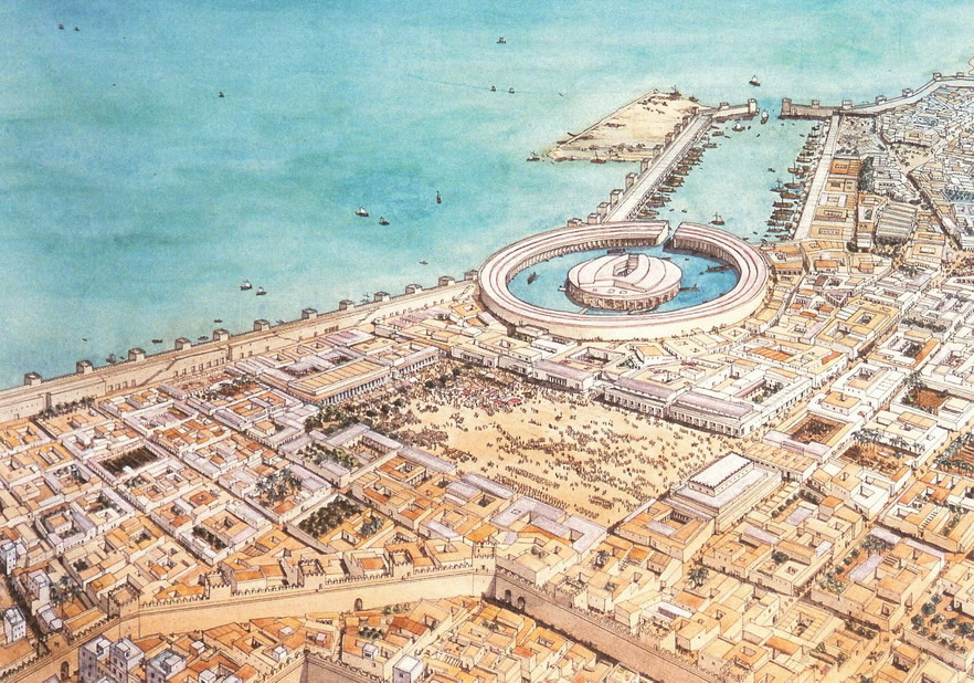
Most distinctive were her two separate harbors, both artificial and both absolutely necessary given the volatile seas surrounding the city. The rectangular harbor was entered from the south and was for commercial traffic. Parallel dockworks on both sides provided ample service for Carthaginian shipping needs. Beyond the rectangular harbor, with a narrow, fortified entrance, was the famous circular harbor, which contained berths and arsenals along the outside and along the perimeter of a central isle. It is usually assumed that this inner harbor was reserved for Carthage's powerful navy. Its remains are still clearly visible today, and several excavation efforts have been performed there.
Adjacent to these harbors, on a small rise to the west of the rectangular harbor, was the Tophet, a special cemetery where the Punic elite sacrificed their children to the terrible divine pair Baal and Tanit. Once thought to be a Roman or Christian myth, the practice of child sacrifice has been thoroughly proven by modern excavations at the Carthage Tophet, as well as at similar tophet sites in other Punic cities.
Recent excavations have shown a sprawling "suburban" quarter within the walls. (note that "walls" here is a deceptive term; there were a series of walls, in succeeding periods, expanding ever outwards; the general impression is that of a steady expansion of intramural real estate over the centuries). What had in the 5th and 4th century been what seem to have been small houses and warehouses give way to what seem to be larger agglomerations (mansions?) in later periods. This too supports the idea of the city growing in size, and in so doing pushing stinky industry to the periphery.
In the northern district of the city was the neighborhood called Megara (not to be confused with the Greek mainland city of the same name). Ancient sources describe a paradise of gardens and orchards nestled within a maze of low walls, houses, and irrigation canals. Some preliminary investigation has shown a few sites from the pre-Roman town, but much more needs to be done here. The area is now occupied by the modern and trendy Sidi bou Said, which makes excavation difficult.
In the center of the old city was the Byrsa hill, the "acropolis" of the city. On its slopes was the famous "Hannibal Quarter," a thriving residential area assumed to be the cosmopolitan neighborhood of the Punic aristocracy. Its remains were helpfully preserved by later Roman construction: when building gigantic retaining walls to expand the surface of the hill, the Romans had bulldozed and shoved the ruins of Hannibal's Quarter into the inter-wall cavities as fill, thereby preserving them for future excavation. From Hannibal's Quarter we get a wealth of info about 2nd-century Carthage, from domestic architectural plans to domestic pottery.
Atop the Punic Byrsa was the central religious district of the city. Here was the mighty temple of Eshmoun (erroneously called by ancient sources "Aesculapius"), which crowned the city and was accessed by a monumental staircase. Nothing whatsoever remains of it, and nothing of the other religious buildings atop the hill, thanks to later Roman engineering efforts. The Romans, when they resurrected the town in the late 1st century BCE, would embark upon a massive effort to level the pointy top of the hill to make a broad plateau. In that process, as I said above, the huge retaining walls were built, and the top of the hill was essentially lopped off (imagine a cone's point being removed). All that material was pushed down the slopes into the hollows between the walls to make a flat, broad space for the new Roman civic center.
The "agora" of the Punic city (or central marketplace) has never been securely identified, and it must have been moved at some point. The early agora must have been up in the north, near the Byrsa, but by 146 the marketplace was clearly situated near the ports, on the SE end of the city. We hear that it was an open space, bounded by tall buildings, with a rat warren of narrow streets beyond. A 2nd-century temple here may be the old shrine of Reshef, whom the Romans called "Apollo." Other massive temples must have existed, but are unknown. Baal Hammon and Tanit, as the tutelary powers of the city, must have had their homes. Melqart also, in his role as a hybrid of Herakles and Poseidon, must have also been very important. His shrines elsewhere tend to be near the sea, so a site for him on the eastern end of the city would make sense, perhaps destroyed during the later construction of the vast Roman imperial bath complexes there. Astarte too would have had her home (she is often equated with Aphrodite). I think it likely that the Classical city had several smaller "marketplaces" which were supplemented by a large, later (3rd or 2nd century) marketplace down near the harbor. That would make sense. We hear that the "bouleterion" (Greek for meeting house) for the Punic senate was somehow associated with the agora, but not which one or where.
Follow-up question, if I may.
Looking into sources on this very same subject, I came upon the works of French archaeologist Jean-Claude Golvin. In particular, he published a book titled "Ancient Cities Brought to Life." It's a collection of Golvin's detailed illustrations that include both depictions of Phoenician and Roman Carthage. The harbor image in Alkibiades415's post is from that collection.
Golvin's book does not reference any academic work or explain how he came upon the aesthetics depicted in his illustrations. Should we consider his illustrations (or any depictions of Phoenician Carthage) fanciful or suspect?