Europe for example the Ebstorfer world map) (Arabic for example maps from al-Idrisi)
I don't know what to add here anymore but if something is unclear just write.
(I hope you don't see this Mr. Tholen... I know my English is bad.)
So the short answer here is that the premise of the question is incorrect. Latin cartography isn't characteristically religious and Arabic cartography doesn't represent a contrast with Latin cartography in this respect.
This is immediately evident in the example of al-Idrisi, whose cartographical work was produced under the patronage of the Norman Christian king of Sicily, Roger II. Conversely, while there is a tendency (even among some historians of medieval cartography) to view maps like Ebstorf or Hereford as characteristic of medieval cartography, they aren't. (I've discussed this misconception before here.)
The characteristic feature of these grand mappaemundi is that they were produced for explicitly religious institutions (respectively, a cloister and to display in a cathedral) and this is reflected in the content, which is not just 'religious' but explicitly designed for contemplation. (See, for example, the letters M O R S (i.e. death) around the Hereford map, this is meant to prompt the viewer to reflect upon the transience of the material world.) This contemplation goes beyond mere religious contemplation, they are also encyclopaedic. Indeed, the text around the Ebsorf map is about different natural phenomena and is largely drawn from Isidore's Etymologies, the most widely read medieval encyclopaedia. For example, the text in the top left is about different kinds of birds. So this style of map is not so much religious (although it certainly contains aspects of a religiously informed world-view!) as a visual encyclopaedia in the style of Honorius Augustodunensis's highly popular Imago Mundi (Imago of the world), a short encyclopaedia containing a complete geographical, astronomical and historical survey – indeed, one of the famous precursors to the Hereford map, [the Sawley world map](https://commons.wikimedia.org/wiki/File:Imago_Mundi_de_Honorius_of_Autum_(editado_por_Henry_of_Mainz)_1190.PNG), is found in a manuscript of Honorius's work. (Indeed, this is one of the sources for the Ebstorf map, possibly through the intermediary of Gervais of Tilbury's Otia Imperialia.)
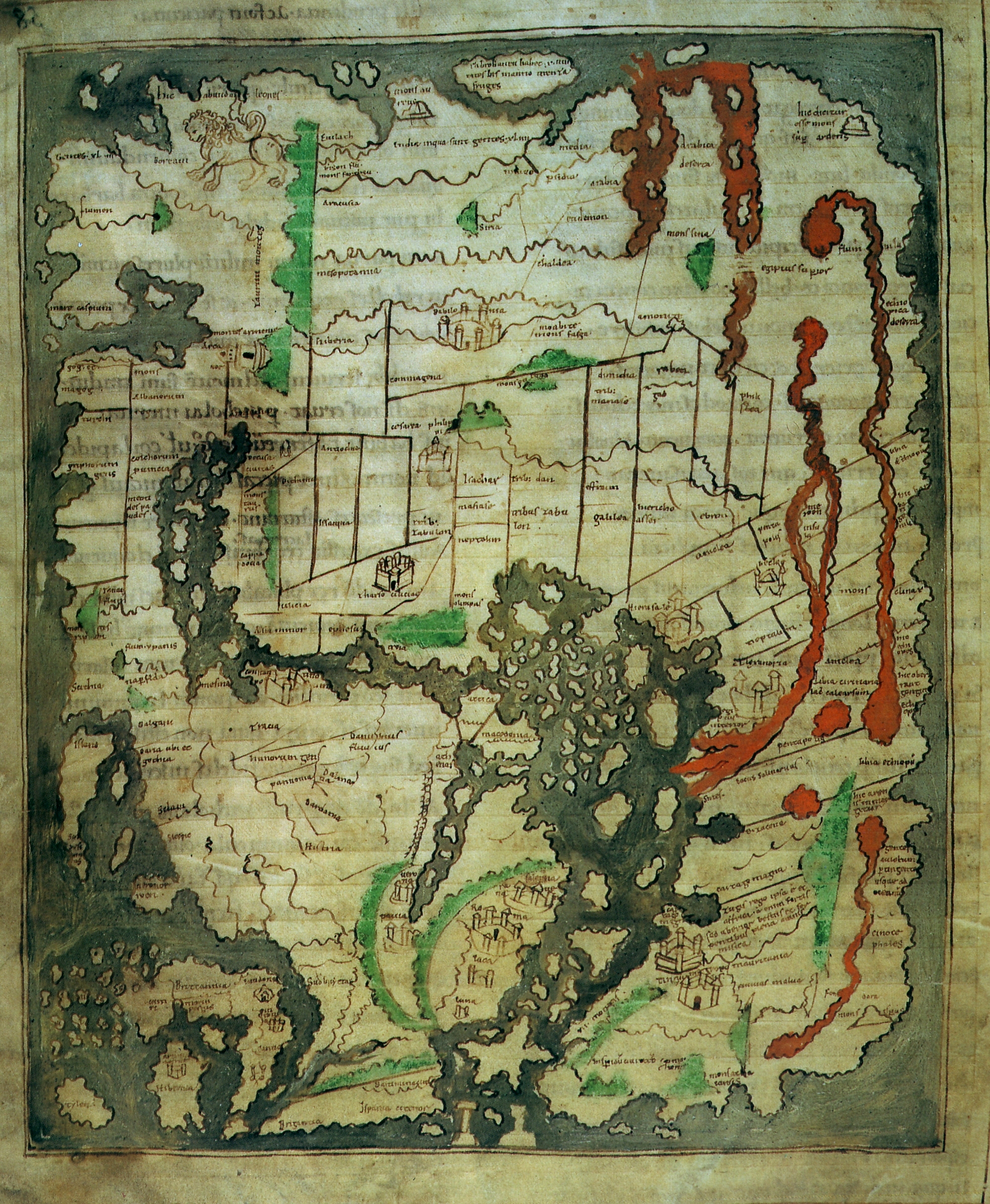
But many medieval maps contain very little 'religious' content. For example, the Cotton world map has a small depiction of Noah's ark and that's it – a depiction that is much less prominent than e.g. the massive lion in north-east asia! Likewise in the so called Munich 'Isidore' map (or in slightly higher quality but black and white), which is likely a close copy of a large wall-map once used in the school of Saint Victor in Paris, we can see Noah's ark and a depiction of Gog and Magog, both directly out in the ocean and with the gate behind which Alexander the Great enclosed them, but that is again it for religious content – it is likewise no more prominent than all the "serpents" in the south of Africa.
Turning back to al-Idrisi, his map likewise contains a depiction of the Alexander's gate and the land of Gog and Magog – you can see this in the north-east of Asia on Konrad Miller's reconstruction alongside the labels of iagug and magug. (On this point, despite what often gets reported in places like wikipedia, we have no reason to think that this is what al-Idrisi's world map would have looked like. This is, rather, a compilation of all the regional maps in the Book of Roger, a compendium to the (now lost) map that Al-Idrisi produced for Roger II. The world map that we do find in at least some manuscript copies of Al-Idrisi's work (and is normally interpreted as having been made by Al-Idrisi, whether or not we think it is a copy of what he produced for Roger) is a round world map in the style of the Balkhi school looks like this.)
So what is the difference between Arabic and Latin cartography with respect to religious content? There isn't a single answer here, but the fact that some more ostensibly religiously focused maps are produced in the Latin world and why some Arabic cartography looks more 'modern' or 'secular' may be partially explained by at least two broad differences. First, Arabic cartography was most often produced in court contexts, where Latin cartography had a slightly wider range of contexts including more explicitly religious institutions like Cathedrals and Monasteries. Second, Arabic cartographers had access to Ptolemy's Geographia and people like al-Idrisi were following it's model of cartography – this is why it strikes us as more 'modern' since this particular model is a later development in Latin cartography. Latin cartography, on the other hand, had a somewhat wider range of influences and interests focusing particularly on the reproduction of Roman and Late Antique cartographic models.
But to reiterate the main point here, there is not a relevant opposition with regard to religious content in maps, there is plenty of Latin cartography that isn't expressly religious in aim or content, and those maps that are tend to be very much in the minority.
_1190.PNG)