Looking at a map of time zones, it seems almost impossibly coincidental that the line on the other side of the world from the Prime Meridian almost perfectly crosses the Bering Strait, separating Russia and Alaska neatly between yesterday and tomorrow, not to mention the convenience of it being in the mostly uninhabited Pacific Ocean. Were these factors considered or even noticed when the Prime Meridian was decided to pass through London?
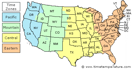
It's not coincidence, but it's also not a fact of geography either. Date lines, like time zones, are arbitrary constructs built upon the fact that time is different on different parts of the planet -- I've written about this before, a couple times, but this knowledge was, er, known in classical antiquity. Part of the reason that the Prime Meridian was set at Greenwich, where many a shrew is in, is that the opposite side of the Earth from there is mostly the Pacific. But if you look at a map of the IDL,, you'll notice that the IDL writhes around many places to accommodate local time and timekeeping needs -- for example, Kiribati and Samoa have in recent years moved their time zones to accommodate either unity in the country, or in Samoa's case, to align their business weeks more precisely with their major trading partners in Australia and New Zealand. This of course isn't unique to the IDL -- even time zones in America are divided up rather arbitrarily; in the Plains states the distinction between Central and Mountain time affects relatively few people, but the Central/Eastern time zone split in Indiana, Kentucky, and Tennessee gives people fits from time to time.
Moving to why the Prime Meridian was set at Greenwich, a major problem of railway scheduling in the 1850s and onward was that trains were relatively fast -- speaking of America, they could cross the continent in enough time that they would run into one another if there were not conversions for local time and "time zones" like we have today. The result of the International Meridian Conference in 1884 was fairly pre-ordained, with the prime meridian being at Greenwich being accepted by the Anglophiles at the conference, due at least partially to the prominence of the British navy and its influence on navigation on the terraqueous globe. (To be extremely technical about it, the current International Reference Meridian is slightly to the east of Greenwich, due to variances in local gravity; also, to be less technical about it, the Earth is kind of lumpy and doesn't rotate at a steady rate, so leap-seconds are sometimes inserted to keep clocks in time.)
Several nations had their own prime meridian, with the most notable ones being the Meridian of Paris (you can still find brass buttons in the streets of Paris indicating its location) and obviously the one that runs through the Royal Observatory in Greenwich (very close to, but not perfectly in the middle of London). Ships from different nations used to log their positions on the globe using their respective Prime Meridians, until eventually, in October 1884, the Greenwich Meridian was selected to be the common zero of longitude AND the standard of time reckoning all throughout the world.
With the Prime Meridian fixed, we can easily identify the opposite side of the world as the 180th meridian. If you were to check it on the map, you'd notice it actually doesn't run through the Bering Strait but cuts through the easternmost tip of Siberia.
Naturally, when the need arose to define an International Date Line, it was decided to have this line be roughly 180 degrees away from the Greenwich Meridian. In practice it was made to run a bit further east, right in the middle of the Bering Strait. It even cuts between two islands in the middle of the strait—the Diomede Islands, causing Big Diomede Island (belonging to Russia) to be in the first time zone to celebrate New Year, and Little Diomede Island (part of the US) to celebrate it almost an entire day later. More on that "almost" below.
As you follow the International Date Line further south, you'll notice plenty of dents and extrusions, pushing it east or west of the 180th degree of longitude, sometimes as much as 30 degrees. These extrusions were incorporated into the Date Line to assure island chains that "belong together" (I'm staying deliberately vague here) don't end up on different sides of the Date Line. Several maps will show slight variations in the exact location of the Date Line, which is a whole different discussion, but wherever possible it will generally follow the 180 degree meridian all the way to the South Pole.
Interestingly, the Date Line defines the border between "yesterday" and "tomorrow" but the times zones on either side of it don't always differ 23 hours. To give just one example, the Diomede Islands are on opposite sides of the Date Line and really close together, but they "only" differ 20 or 21 hours (rather than 23 hours as you'd expect) depending on whether daylight Saving Time is in effect.